 |
Bibliography | Home | |
![]()
|
Although Mt. Shasta often has a heavy snow pack, which then melts throughout the summer, very little surface water runs off the mountain. Instead the water percolates down through the lava tubes and pops up as springs on the Shasta valley floor. This helps to keep water flows up and temperatures down in parts of the river, making these sections suitable habitat for trout and salmon. |
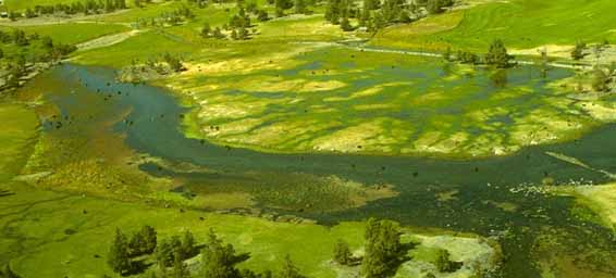 Springs fed by snowmelt pop out of the ground to feed Big Springs Creek. |
| Rainfall in the Klamath Mountains can exceed 40 inches a year. Most of the water flowing from the upper Shasta River and Parks Creek is captured in Dwinell Reservoir, however, and released throughout the summer for irrigation. The reservoir also traps flood waters and thus reduces flood damage to the Shasta Valley below. The diversion of surface flows and groundwater pumping substantially reduce Shasta River flows during the summer. Of the tributaries to the Shasta, surface flows are maintained in Yreka Creek through the summer as a result of releases from Greenhorn Reservoir, and sub-surface inflows below the Yreka Wastewater Treatment Plant. Parks Creek is intermittently dried up then re-forms from spring water inflows. Julian Creek is nearly always sub-surface through the summer, as are the lower reaches of the Little Shasta. |
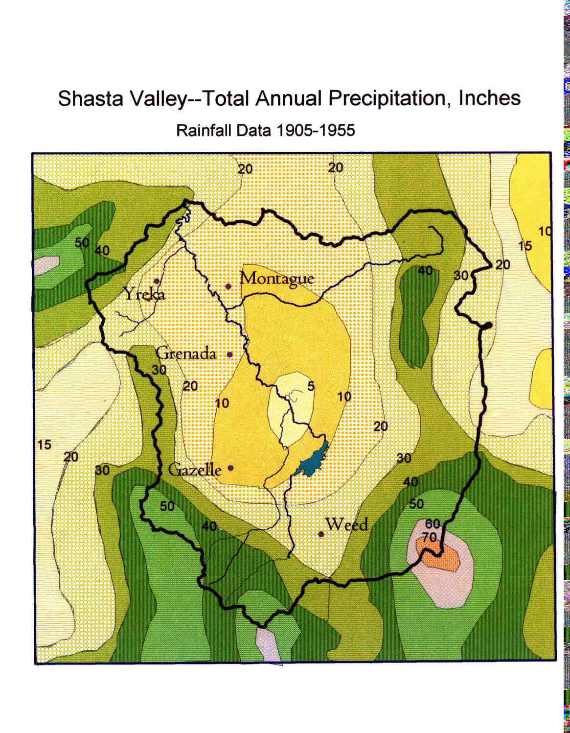 |
The Shasta
Valley is in a rain shadow created by the Klamath Mountains, which lie to
the west. Moist air masses moving eastward from the Pacific Ocean are drained
of their water as they climb over these mountains. Precipitation on the
valley floor is only 11 to 17 inches per year and in fact drops to only
five inches around Big Springs. The map at left was created in ArcView by
Dave Webb, Shasta CRMP coordinator.
Click on Map for full view. |
|
|
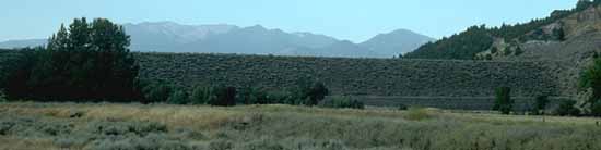
| Dwinell Dam captures and holds the water flowing from the upper Shasta River and Parks Creek, changing the natural hydrology of the river. |
![]()
References
Booher, L. J., C. E. Houston, A. D. Reed, M. V. Maxwell, and S. D. Nelson. 1959. Analysis of the Montague Water Conservation District. University of California, Davis, Agricultural Extension Service. Yreka, CA. 18 pp. [340kb]**
Clawson, R. F., D. J. Cahoon, and J. M. Lacey. 1986. Shasta/Klamath Rivers Water Quality Study. California Department of Water Resources, Northern District. Sacramento, CA. 28 pp. [75kb]**
![]()
| www.krisweb.com |