 |
Bibliography | Home | |
![]()
|
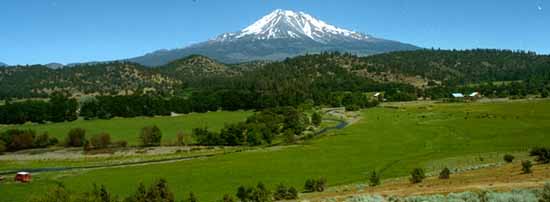
The Shasta River Basin embraces an 800 square mile area of Siskiyou County in the north central part of California. Mount Shasta dominates the landscape, towering over 14,000 feet to the south. Melting snow from Mount Shasta does not contribute significantly to surface flows in the upper Shasta River because run-off sinks into the porous volcanic slopes and reappears from springs on the Shasta Valley floor. |
 |
|
The headwaters of the Shasta River are near Mount Eddy and the upper river above Dwinell Reservoir is swift and falls in elevation rapidly. Before the dam was built, these stretches of the river were prime spawning habitat for salmon and steelhead. The river below Dwinell Dam meanders along the Shasta Valley floor, which is 30 miles across at its widest. Springs in this reach add to flows and provide much needed cool water for juvenile salmon and steelhead in summer. The Klamath mountains, to the west, strip most of the moisture from ocean air currents as they move eastward. The Shasta Valley itself receives only 11-17 inches of rain annually. Because so little rain falls in the Shasta Valley during the growing season, ranchers rely heavily on streamflows and ground water to irrigate crops and to water their livestock. |
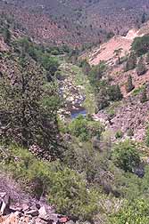 |
The lower portion of the Shasta River
flows through a deep, narrow gorge. This picture shows the parched, shrubby
watershed. The Shasta River joins the Klamath about three miles north of this
site. The gorge is a key location for chinook salmon spawning in fall and winter, but stream temperatures in
summer are too warm for adult or juvenile salmonids.
|
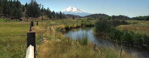 |
| Although fishing opportunities along the Shasta River are limited, the river produces salmon and steelhead that support fisheries in the Klamath River and in the ocean. |
![]()
| www.krisweb.com |