| Agency |
A.A. Rich and Associates |
| Basin |
East Marin-Sonoma |
| Caption |
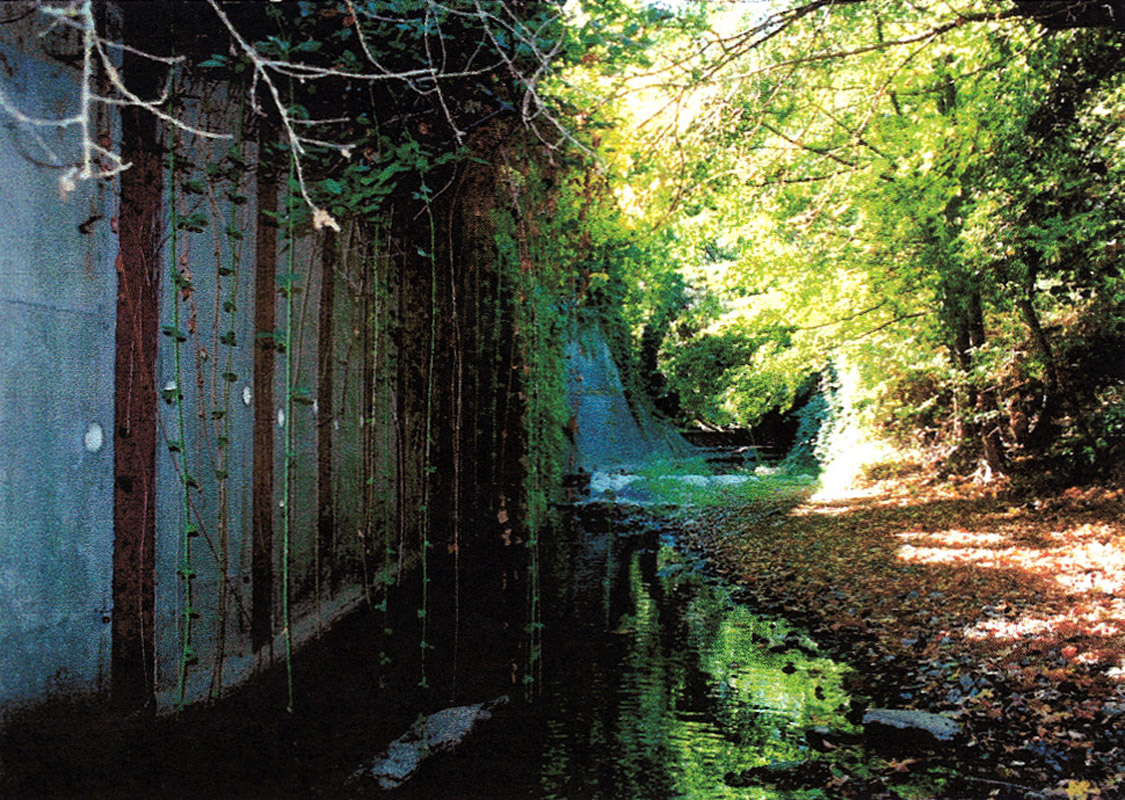
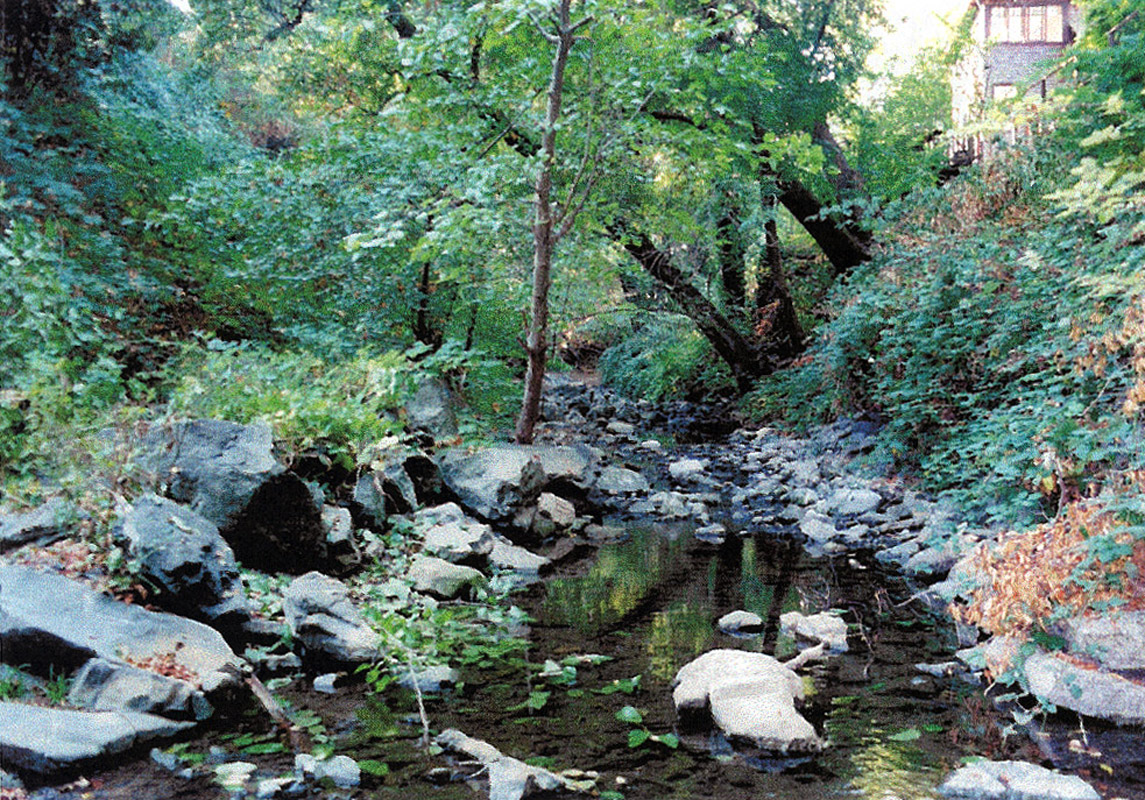
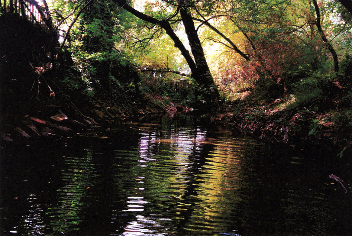
Habitat typing site SA-054 in San Anselmo Creek, located between Nokomis Avenue and Sleepy Hollow Creek, contained a lateral scour pool with an average depth of 0.36 meters and associated with a concrete wall. This section was mostly channelized and therefore poor habitat for steelhead trout (Rich, 2000). This area was photographed and habitat typed on October 8, 1999 by A.A. Rich and Associates. |
| CaptionTemplate |
[Description] |
| Category |
Monitoring |
| Description |
Habitat typing site SA-054 in San Anselmo Creek, located between Nokomis Avenue and Sleepy Hollow Creek, contained a lateral scour pool with an average depth of 0.36 meters and associated with a concrete wall. This section was mostly channelized and therefore poor habitat for steelhead trout (Rich, 2000). This area was photographed and habitat typed on October 8, 1999 by A.A. Rich and Associates. |
| Filename |
rich_sananselmo_sa12_1999.jpg |
| Filesize |
458387 |
| Meta_Id |
Rich_FCMCW |
| Notefile |
emarins.htm#photos |
| Path |
topics/cm/rich_sananselmo_sa12_1999.jpg |
| Photo Number |
3 |
| Restriction |
None |
| Series |
Monitoring: Monitoring Sites in San Anselmo Creek 1999 |
| SubBasin |
Corte Madera Creek |
| UpdateDate |
8/26/2006 |
| UpdateName |
JEA |
| Agency |
A.A. Rich and Associates |
| Basin |
East Marin-Sonoma |
| Caption |
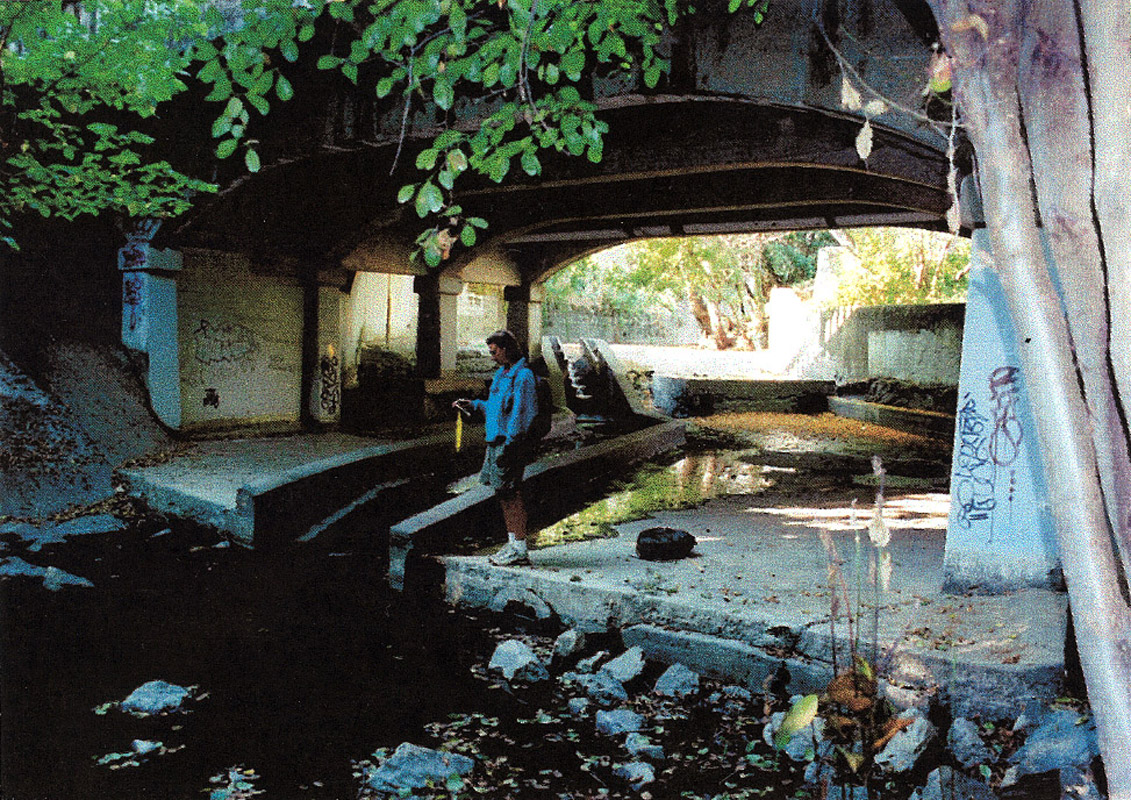
Habitat typing site SA-076, located at Saunders Avenue and the Sir Francis Drake High School, contained a Denil fish ladder. This area was photographed and habitat typed on October 8, 1999 by A.A. Rich and Associates. |
| CaptionTemplate |
[Description] |
| Category |
Monitoring |
| Description |
Habitat typing site SA-076, located at Saunders Avenue and the Sir Francis Drake High School, contained a Denil fish ladder. This area was photographed and habitat typed on October 8, 1999 by A.A. Rich and Associates. |
| Filename |
rich_sananselmo_sa13_1999.jpg |
| Filesize |
527385 |
| Meta_Id |
Rich_FCMCW |
| Notefile |
emarins.htm#photos |
| Path |
topics/cm/rich_sananselmo_sa13_1999.jpg |
| Photo Number |
4 |
| Restriction |
None |
| Series |
Monitoring: Monitoring Sites in San Anselmo Creek 1999 |
| SubBasin |
Corte Madera Creek |
| UpdateDate |
8/26/2006 |
| UpdateName |
JEA |
| Agency |
A.A. Rich and Associates |
| Basin |
East Marin-Sonoma |
| Caption |
Habitat typing site SA-084, located between Saunders Avenue and San Anselmo Avenue at Lansdale Station, contained a lateral scour pool with an average depth of 0.28 meters and associated with riprap. As with the section downstream, there were many channelized portion of creek that created poor trout habitat (Rich, 2000). This area was photographed and habitat typed on October 18, 1999 by A.A. Rich and Associates. |
| CaptionTemplate |
[Description] |
| Category |
Monitoring |
| Description |
Habitat typing site SA-084, located between Saunders Avenue and San Anselmo Avenue at Lansdale Station, contained a lateral scour pool with an average depth of 0.28 meters and associated with riprap. As with the section downstream, there were many channelized portion of creek that created poor trout habitat (Rich, 2000). This area was photographed and habitat typed on October 18, 1999 by A.A. Rich and Associates. |
| Filename |
rich_sananselmo_sa15_1999.jpg |
| Filesize |
468124 |
| Meta_Id |
Rich_FCMCW |
| Notefile |
emarins.htm#photos |
| Path |
topics/cm/rich_sananselmo_sa15_1999.jpg |
| Photo Number |
5 |
| Restriction |
None |
| Series |
Monitoring: Monitoring Sites in San Anselmo Creek 1999 |
| SubBasin |
Corte Madera Creek |
| UpdateDate |
8/26/2006 |
| UpdateName |
JEA |
| Agency |
A.A. Rich and Associates |
| Basin |
East Marin-Sonoma |
| Caption |
Habitat typing site SA-122, located at Pastori Avenue, contained another Denil fish ladder. This area was photographed and habitat typed on October 18, 1999 by A.A. Rich and Associates. |
| CaptionTemplate |
[Description] |
| Category |
Monitoring |
| Description |
Habitat typing site SA-122, located at Pastori Avenue, contained another Denil fish ladder. This area was photographed and habitat typed on October 18, 1999 by A.A. Rich and Associates. |
| Filename |
rich_sananselmo_sa22_1999.jpg |
| Filesize |
615705 |
| Meta_Id |
Rich_FCMCW |
| Notefile |
emarins.htm#photos |
| Path |
topics/cm/rich_sananselmo_sa22_1999.jpg |
| Photo Number |
7 |
| Restriction |
None |
| Series |
Monitoring: Monitoring Sites in San Anselmo Creek 1999 |
| SubBasin |
Corte Madera Creek |
| UpdateDate |
8/26/2006 |
| UpdateName |
JEA |
| Agency |
A.A. Rich and Associates |
| Basin |
East Marin-Sonoma |
| Caption |
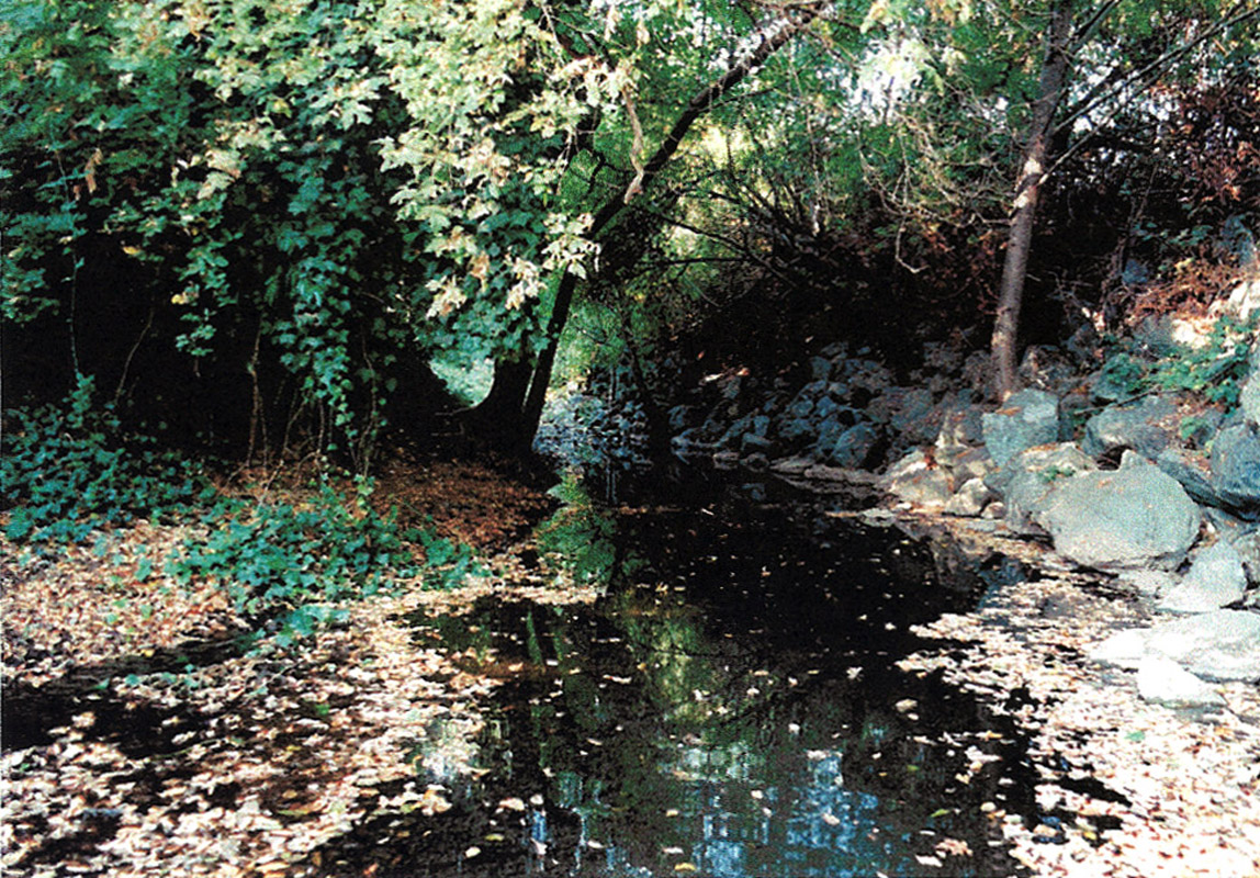
Habitat typing site SA-111, located between San Anselmo Avenue at Lansdale Station and #10 Adler Court, contained cascade pools with an average depth of 0.1 to 0.33 meters deep. Fewer retaining walls in this reach compared to downstream provided a more natural look (Rich, 2000). This area was photographed and habitat typed on October 18, 1999 by A.A. Rich and Associates. |
| CaptionTemplate |
[Description] |
| Category |
Monitoring |
| Description |
Habitat typing site SA-111, located between San Anselmo Avenue at Lansdale Station and #10 Adler Court, contained cascade pools with an average depth of 0.1 to 0.33 meters deep. Fewer retaining walls in this reach compared to downstream provided a more natural look (Rich, 2000). This area was photographed and habitat typed on October 18, 1999 by A.A. Rich and Associates. |
| Filename |
rich_sananselmo_sa24_1999.jpg |
| Filesize |
534310 |
| Meta_Id |
Rich_FCMCW |
| Notefile |
emarins.htm#photos |
| Path |
topics/cm/rich_sananselmo_sa24_1999.jpg |
| Photo Number |
6 |
| Restriction |
None |
| Series |
Monitoring: Monitoring Sites in San Anselmo Creek 1999 |
| SubBasin |
Corte Madera Creek |
| UpdateDate |
8/26/2006 |
| UpdateName |
JEA |
| Agency |
A.A. Rich and Associates |
| Basin |
East Marin-Sonoma |
| Caption |
Habitat typing site SA-133, located between Fairfax Creek and #40 Inyo Avenue, contained a lateral scour pool with an average depth of .38 meters and associated with bank cuts. Note the bare bank which appears to be eroding into the creek. This area was photographed and habitat typed on October 20, 1999 by A.A. Rich and Associates. |
| CaptionTemplate |
[Description] |
| Category |
Monitoring |
| Description |
Habitat typing site SA-133, located between Fairfax Creek and #40 Inyo Avenue, contained a lateral scour pool with an average depth of .38 meters and associated with bank cuts. Note the bare bank which appears to be eroding into the creek. This area was photographed and habitat typed on October 20, 1999 by A.A. Rich and Associates. |
| Filename |
rich_sananselmo_sa25_1999.jpg |
| Filesize |
420702 |
| Meta_Id |
Rich_FCMCW |
| Notefile |
emarins.htm#photos |
| Path |
topics/cm/rich_sananselmo_sa25_1999.jpg |
| Photo Number |
8 |
| Restriction |
None |
| Series |
Monitoring: Monitoring Sites in San Anselmo Creek 1999 |
| SubBasin |
Corte Madera Creek |
| UpdateDate |
8/26/2006 |
| UpdateName |
JEA |
| Agency |
A.A. Rich and Associates |
| Basin |
East Marin-Sonoma |
| Caption |
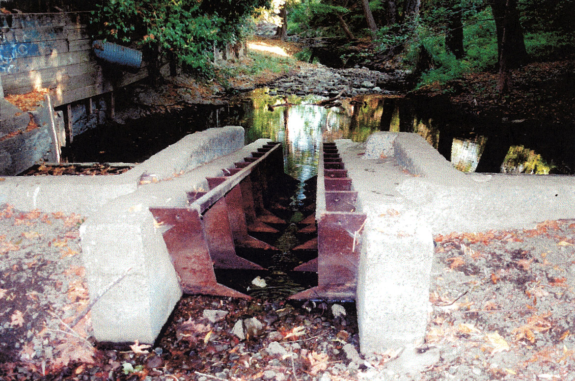
Habitat typing site SA-144, located at Pacheco Avenue, contained a mid-channel pool with an average depth of 0.35 meters. The dam in the picture measures about three meters high, nine meters wide, and over 0.5 meters deep and has a cut in the middle to allow the creek to flow through (Rich, 2000). This area was photographed and habitat typed on October 20, 1999 by A.A. Rich and Associates. |
| CaptionTemplate |
[Description] |
| Category |
Monitoring |
| Description |
Habitat typing site SA-144, located at Pacheco Avenue, contained a mid-channel pool with an average depth of 0.35 meters. The dam in the picture measures about three meters high, nine meters wide, and over 0.5 meters deep and has a cut in the middle to allow the creek to flow through (Rich, 2000). This area was photographed and habitat typed on October 20, 1999 by A.A. Rich and Associates. |
| Filename |
rich_sananselmo_sa27_1999.jpg |
| Filesize |
484891 |
| Meta_Id |
Rich_FCMCW |
| Notefile |
emarins.htm#photos |
| Path |
topics/cm/rich_sananselmo_sa27_1999.jpg |
| Photo Number |
9 |
| Restriction |
None |
| Series |
Monitoring: Monitoring Sites in San Anselmo Creek 1999 |
| SubBasin |
Corte Madera Creek |
| UpdateDate |
8/26/2006 |
| UpdateName |
JEA |
| Agency |
A.A. Rich and Associates |
| Basin |
East Marin-Sonoma |
| Caption |
Habitat typing site SA-158A, located between Pacheco Avenue and Creek Road, contained a lateral scour pool with an average depth of 0.18 meters and was associated with a concrete wall. This area was photographed and habitat typed on October 20, 1999 by A.A. Rich and Associates. |
| CaptionTemplate |
[Description] |
| Category |
Monitoring |
| Description |
Habitat typing site SA-158A, located between Pacheco Avenue and Creek Road, contained a lateral scour pool with an average depth of 0.18 meters and was associated with a concrete wall. This area was photographed and habitat typed on October 20, 1999 by A.A. Rich and Associates. |
| Filename |
rich_sananselmo_sa30_1999.jpg |
| Filesize |
420781 |
| Meta_Id |
Rich_FCMCW |
| Notefile |
emarins.htm#photos |
| Path |
topics/cm/rich_sananselmo_sa30_1999.jpg |
| Photo Number |
10 |
| Restriction |
None |
| Series |
Monitoring: Monitoring Sites in San Anselmo Creek 1999 |
| SubBasin |
Corte Madera Creek |
| UpdateDate |
8/26/2006 |
| UpdateName |
JEA |
| Agency |
A.A. Rich and Associates |
| Basin |
East Marin-Sonoma |
| Caption |
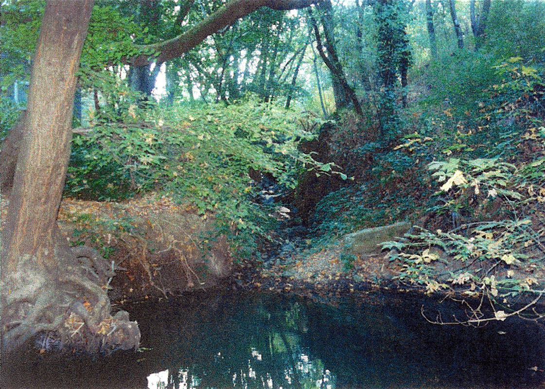
Habitat typing site SA-195, located between Bolinas Road and Meadow Way, contained a lateral scour pool with an average depth of 0.45 meters and was associated with a rootwad. This area was photographed and habitat typed on October 14, 1999 by A.A. Rich and Associates. |
| CaptionTemplate |
[Description] |
| Category |
Monitoring |
| Description |
Habitat typing site SA-195, located between Bolinas Road and Meadow Way, contained a lateral scour pool with an average depth of 0.45 meters and was associated with a rootwad. This area was photographed and habitat typed on October 14, 1999 by A.A. Rich and Associates. |
| Filename |
rich_sananselmo_sa33_1999.jpg |
| Filesize |
603537 |
| Meta_Id |
Rich_FCMCW |
| Notefile |
emarins.htm#photos |
| Path |
topics/cm/rich_sananselmo_sa33_1999.jpg |
| Photo Number |
11 |
| Restriction |
None |
| Series |
Monitoring: Monitoring Sites in San Anselmo Creek 1999 |
| SubBasin |
Corte Madera Creek |
| UpdateDate |
8/26/2006 |
| UpdateName |
JEA |
| Agency |
A.A. Rich and Associates |
| Basin |
East Marin-Sonoma |
| Caption |
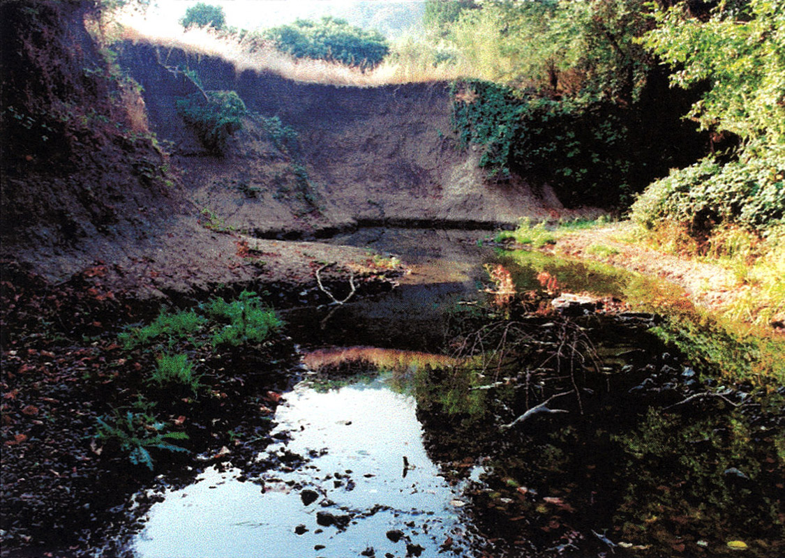
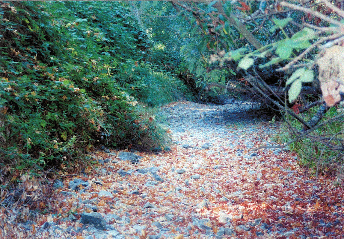
Habitat typing site SA-197, located just downstream of Meadow Way, contained dry habitat and spawning gravel. The creek was dry beginning at this site and extending over a mile, although the substrate almost throughout was composed of spawning gravel (Rich, 2000). This area was photographed and habitat typed on October 14, 1999 by A.A. Rich and Associates. |
| CaptionTemplate |
[Description] |
| Category |
Monitoring |
| Description |
Habitat typing site SA-197, located just downstream of Meadow Way, contained dry habitat and spawning gravel. The creek was dry beginning at this site and extending over a mile, although the substrate almost throughout was composed of spawning gravel (Rich, 2000). This area was photographed and habitat typed on October 14, 1999 by A.A. Rich and Associates. |
| Filename |
rich_sananselmo_sa35_1999.jpg |
| Filesize |
562821 |
| Meta_Id |
Rich_FCMCW |
| Notefile |
emarins.htm#photos |
| Path |
topics/cm/rich_sananselmo_sa35_1999.jpg |
| Photo Number |
12 |
| Restriction |
None |
| Series |
Monitoring: Monitoring Sites in San Anselmo Creek 1999 |
| SubBasin |
Corte Madera Creek |
| UpdateDate |
8/26/2006 |
| UpdateName |
JEA |
| Agency |
A.A. Rich and Associates |
| Basin |
East Marin-Sonoma |
| Caption |
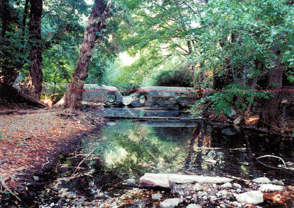
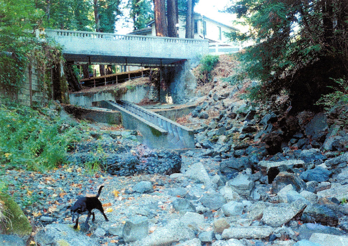
Habitat typing site SA-198B, located at Canyon Road, contained dry habitat and a Denil fish ladder. This area was photographed and habitat typed on November 4, 1999 by A.A. Rich and Associates. |
| CaptionTemplate |
[Description] |
| Category |
Monitoring |
| Description |
Habitat typing site SA-198B, located at Canyon Road, contained dry habitat and a Denil fish ladder. This area was photographed and habitat typed on November 4, 1999 by A.A. Rich and Associates. |
| Filename |
rich_sananselmo_sa38_1999.jpg |
| Filesize |
531038 |
| Meta_Id |
Rich_FCMCW |
| Notefile |
emarins.htm#photos |
| Path |
topics/cm/rich_sananselmo_sa38_1999.jpg |
| Photo Number |
14 |
| Restriction |
None |
| Series |
Monitoring: Monitoring Sites in San Anselmo Creek 1999 |
| SubBasin |
Corte Madera Creek |
| UpdateDate |
8/26/2006 |
| UpdateName |
JEA |
| Agency |
A.A. Rich and Associates |
| Basin |
East Marin-Sonoma |
| Caption |
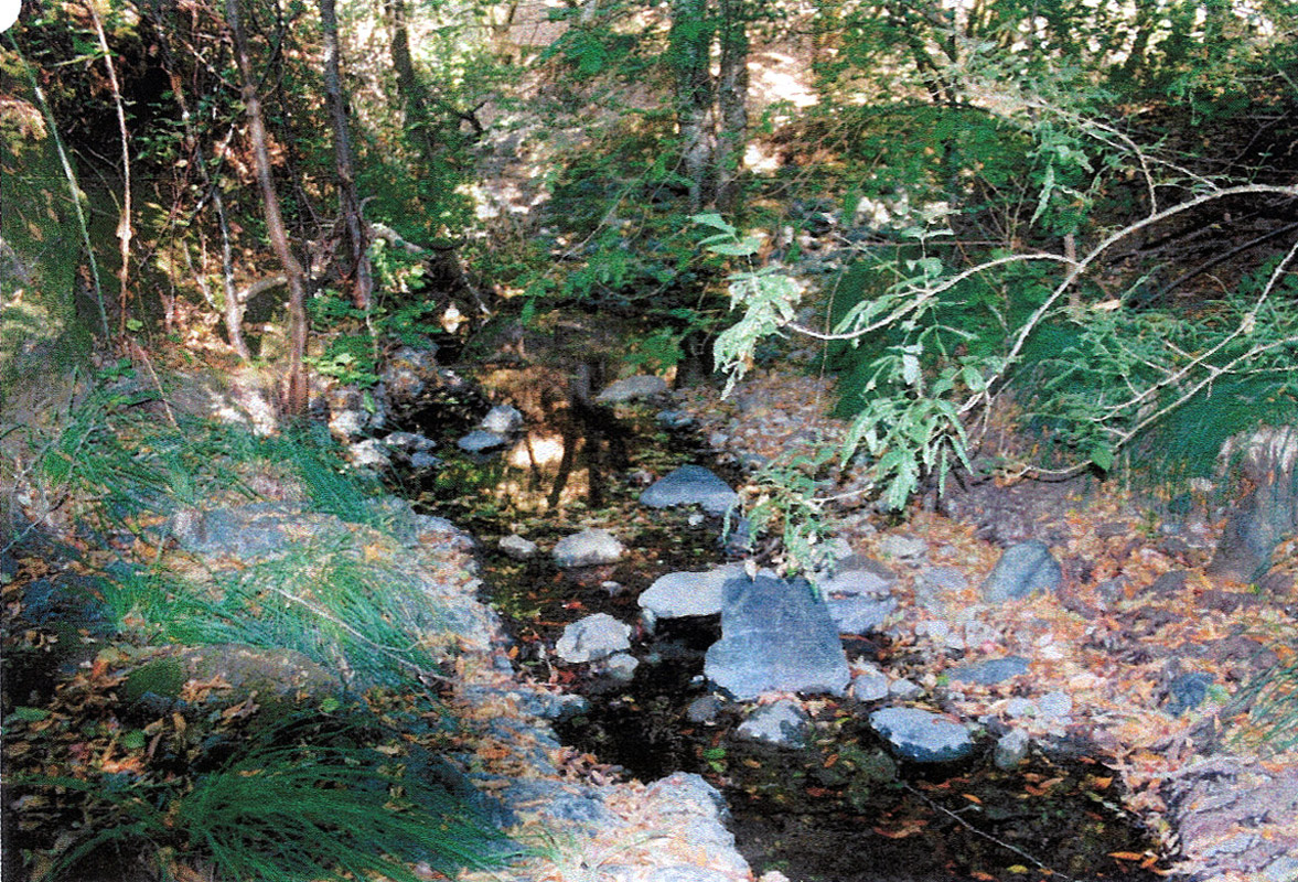
Habitat typing site SA-216, located in the Cascade Canyon Open Space Preserve just downstream of Cascade Creek, contained a lateral scour pool with an average depth of 0.14 meters and associated with bedrock. The area within this preserve seemed to have the best steelhead trout habitat in San Anselmo Creek, although flows were low by the end of summer (Rich, 2000). This area was photographed and habitat typed on September 10, 1999 by A.A. Rich and Associates. |
| CaptionTemplate |
[Description] |
| Category |
Monitoring |
| Description |
Habitat typing site SA-216, located in the Cascade Canyon Open Space Preserve just downstream of Cascade Creek, contained a lateral scour pool with an average depth of 0.14 meters and associated with bedrock. The area within this preserve seemed to have the best steelhead trout habitat in San Anselmo Creek, although flows were low by the end of summer (Rich, 2000). This area was photographed and habitat typed on September 10, 1999 by A.A. Rich and Associates. |
| Filename |
rich_sananselmo_sa42_1999.jpg |
| Filesize |
566928 |
| Meta_Id |
Rich_FCMCW |
| Notefile |
emarins.htm#photos |
| Path |
topics/cm/rich_sananselmo_sa42_1999.jpg |
| Photo Number |
15 |
| Restriction |
None |
| Series |
Monitoring: Monitoring Sites in San Anselmo Creek 1999 |
| SubBasin |
Corte Madera Creek |
| UpdateDate |
8/26/2006 |
| UpdateName |
JEA |
| Agency |
A.A. Rich and Associates |
| Basin |
East Marin-Sonoma |
| Caption |
Habitat typing site SA-012 in San Anselmo Creek, located between Sir Francis Drake Boulevard Bridges at the San Anselmo town limit and at the Ross Valley Veterinary Hospital, contained a lateral scour pool with an average depth of 0.22 meters and associated with bank cut. This pool was created by an artificial rock dam at the downstream side. Within the bridges previously noted one potential spawning area was seen during habitat typing, although low streamflows limited summer steelhead trout habitat (Rich, 2000). Photo taken and habitat typing conducted by A.A. Rich and Associates on August 11, 1999. |
| CaptionTemplate |
[Description] |
| Category |
Monitoring |
| Description |
Habitat typing site SA-012 in San Anselmo Creek, located between Sir Francis Drake Boulevard Bridges at the San Anselmo town limit and at the Ross Valley Veterinary Hospital, contained a lateral scour pool with an average depth of 0.22 meters and associated with bank cut. This pool was created by an artificial rock dam at the downstream side. Within the bridges previously noted one potential spawning area was seen during habitat typing, although low streamflows limited summer steelhead trout habitat (Rich, 2000). Photo taken and habitat typing conducted by A.A. Rich and Associates on August 11, 1999. |
| Filename |
rich_sananselmo_sa5_1999.jpg |
| Filesize |
436614 |
| Meta_Id |
Rich_FCMCW |
| Notefile |
emarins.htm#photos |
| Path |
topics/cm/rich_sananselmo_sa5_1999.jpg |
| Photo Number |
1 |
| Restriction |
None |
| Series |
Monitoring: Monitoring Sites in San Anselmo Creek 1999 |
| SubBasin |
Corte Madera Creek |
| UpdateDate |
8/26/2006 |
| UpdateName |
JEA |
| Agency |
A.A. Rich and Associates |
| Basin |
East Marin-Sonoma |
| Caption |
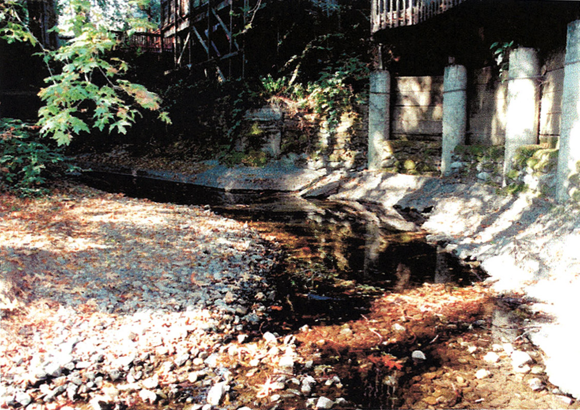
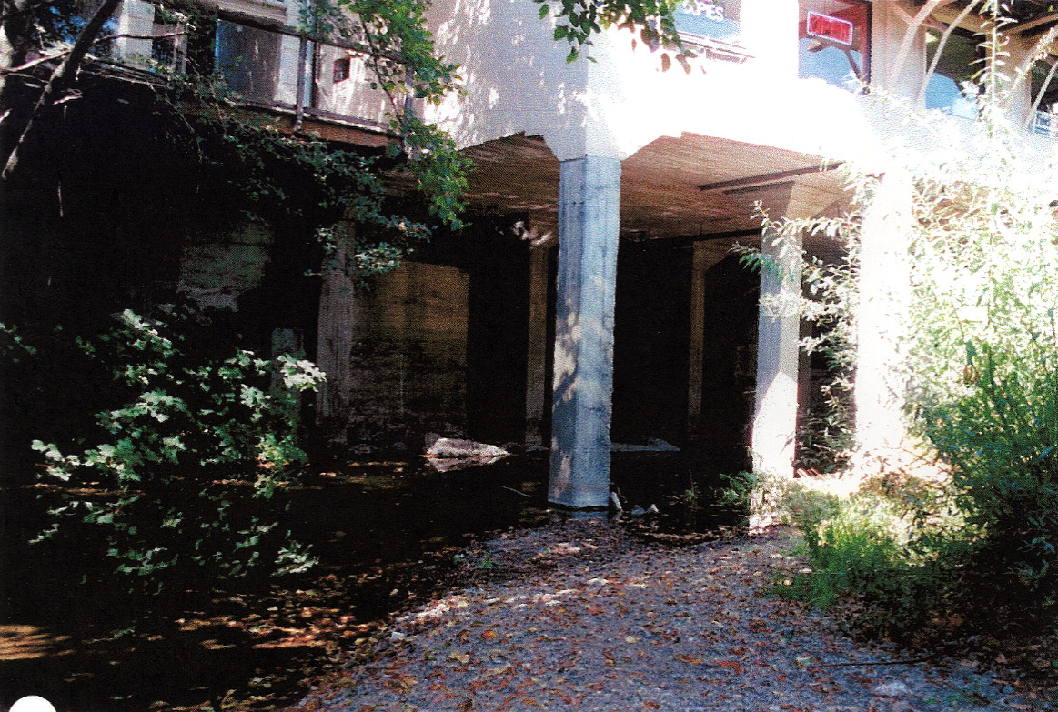
Habitat typing site SA-021 in San Anselmo Creek, located in downtown San Anselmo, contained a lateral scour pool with an average depth of 0.22 meters and associated with concrete pillars. The reach flowing through San Anselmo consisted of very poor steelhead trout habitat (Rich, 2000). This area was photographed was on September 29, 1999 and habitat typed on August 6, 1999 by A.A. Rich and Associates. |
| CaptionTemplate |
[Description] |
| Category |
Monitoring |
| Description |
Habitat typing site SA-021 in San Anselmo Creek, located in downtown San Anselmo, contained a lateral scour pool with an average depth of 0.22 meters and associated with concrete pillars. The reach flowing through San Anselmo consisted of very poor steelhead trout habitat (Rich, 2000). This area was photographed was on September 29, 1999 and habitat typed on August 6, 1999 by A.A. Rich and Associates. |
| Filename |
rich_sananselmo_sa9_1999.jpg |
| Filesize |
511596 |
| Meta_Id |
Rich_FCMCW |
| Notefile |
emarins.htm#photos |
| Path |
topics/cm/rich_sananselmo_sa9_1999.jpg |
| Photo Number |
2 |
| Restriction |
None |
| Series |
Monitoring: Monitoring Sites in San Anselmo Creek 1999 |
| SubBasin |
Corte Madera Creek |
| UpdateDate |
8/26/2006 |
| UpdateName |
JEA |