|
Area/Topic | Bibliography | Background | Hypotheses | Home |
Photo Pages: Meta Information
This page contains detailed information from the KRIS Photodatabase table about photos from sub-basin Sonoma Creek and series Monitoring: Carriger Creek Stream Survey 2000. For a list of photo pages sorted by series, click here. For a list of photo pages sorted by sub-basin, click here.
| Agency | Southern Sonoma County Resource Conservation District |
| Basin | East Marin-Sonoma |
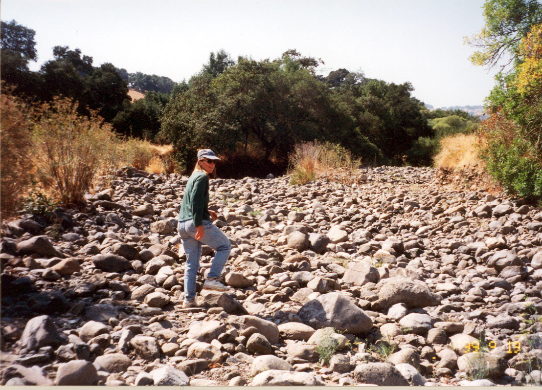
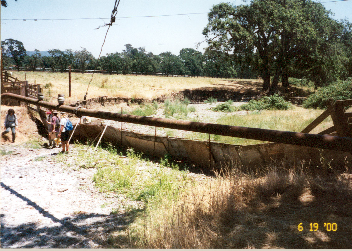
| Caption | This photo shows a degraded section of Carriger Creek, labeled the Intermittent Reach during stream surveys in 2000. Laurel Collins, pictured here, conducted the survey. Notice the aggraded stream bed, sorted small boulder material, and lack of salmonid habitat features. Photo provided by Laurel Collins. |
| CaptionTemplate | [Description] |
| Category | Monitoring |
| Description | This photo shows a degraded section of Carriger Creek, labeled the Intermittent Reach during stream surveys in 2000. Laurel Collins, pictured here, conducted the survey. Notice the aggraded stream bed, sorted small boulder material, and lack of salmonid habitat features. Photo provided by Laurel Collins. |
| Filename | no10pg27intermittent.jpg |
| Filesize | 410849 |
| Meta_Id | Collins_son |
| Notefile | emarins.htm#collins |
| Path | topics/sc/no10pg27intermittent.jpg |
| Photo Number | 1 |
| Photographer | Laurel Collins |
| Restriction | None |
| Series | Monitoring: Carriger Creek Stream Survey 2000 |
| SubBasin | Sonoma Creek |
| UpdateDate | 8/26/2006 |
| UpdateName | JEA |
| Agency | Southern Sonoma County Resource Conservation District |
| Basin | East Marin-Sonoma |
| Caption | This photo shows a high, unstable bank on an aggraded section of Carriger Creek, labeled the Intermittent Reach during stream surveys in 2000. Notice the algae covered pool and lack of flow. Photo provided by Laurel Collins. |
| CaptionTemplate | [Description] |
| Category | Monitoring |
| Description | This photo shows a high, unstable bank on an aggraded section of Carriger Creek, labeled the Intermittent Reach during stream surveys in 2000. Notice the algae covered pool and lack of flow. Photo provided by Laurel Collins. |
| Filename | no11intermittent.jpg |
| Filesize | 506549 |
| Meta_Id | Collins_son |
| Notefile | emarins.htm#collins |
| Path | topics/sc/no11intermittent.jpg |
| Photo Number | 2 |
| Photographer | Laurel Collins |
| Restriction | None |
| Series | Monitoring: Carriger Creek Stream Survey 2000 |
| SubBasin | Sonoma Creek |
| UpdateDate | 8/26/2006 |
| UpdateName | JEA |
| Agency | Southern Sonoma County Resource Conservation District |
| Basin | East Marin-Sonoma |
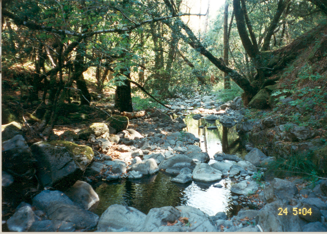
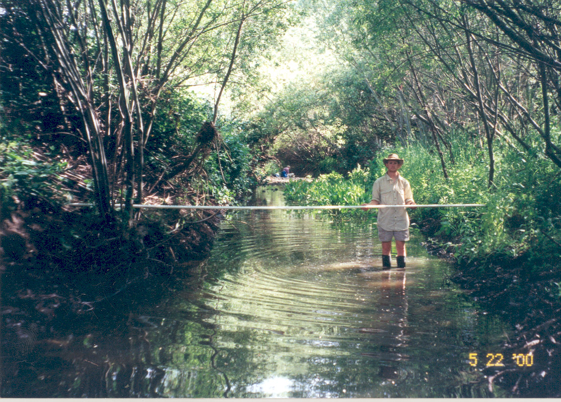
| Caption | This photo shows a shaded riparian section of Carriger Creek, labeled the Steelhead Reach during stream surveys in 2000. An intact riparian canopy helps keep stream temperatures cool, and boulder scour pools, pictured here, provide valuable juvenile steelhead habitat. Photo provided by Laurel Collins. |
| CaptionTemplate | [Description] |
| Category | Monitoring |
| Description | This photo shows a shaded riparian section of Carriger Creek, labeled the Steelhead Reach during stream surveys in 2000. An intact riparian canopy helps keep stream temperatures cool, and boulder scour pools, pictured here, provide valuable juvenile steelhead habitat. Photo provided by Laurel Collins. |
| Filename | no12neg29steelhead.jpg |
| Filesize | 441672 |
| Meta_Id | Collins_son |
| Notefile | emarins.htm#collins |
| Path | topics/sc/no12neg29steelhead.jpg |
| Photo Number | 3 |
| Photographer | Laurel Collins |
| Restriction | None |
| Series | Monitoring: Carriger Creek Stream Survey 2000 |
| SubBasin | Sonoma Creek |
| UpdateDate | 8/26/2006 |
| UpdateName | JEA |
| Agency | Southern Sonoma County Resource Conservation District |
| Basin | East Marin-Sonoma |
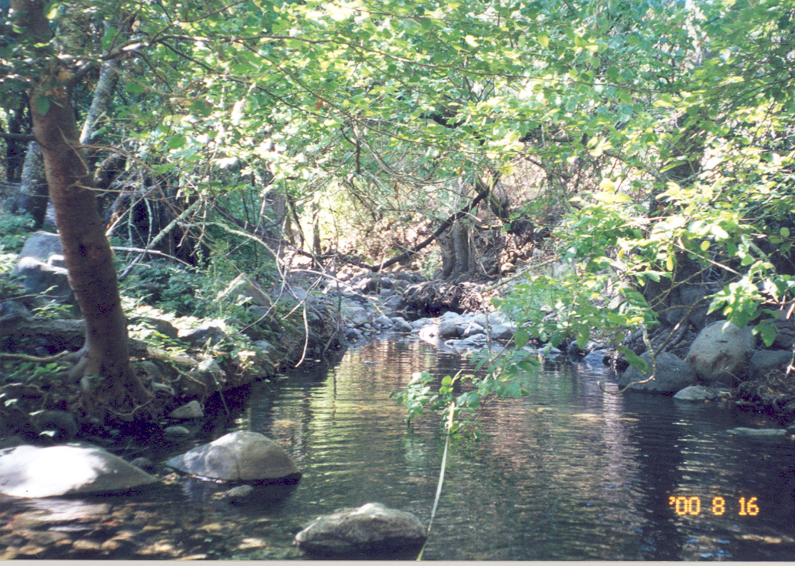
| Caption | This photo shows a shaded riparian section of Carriger Creek, labeled the Diversion Reach during stream surveys in 2000. The large alder on the left not only provides shade to keep stream temperatures cool, but the roots hold together a complex structure of undercut banks and protective cover for juvenile steelhead. Photo provided by Laurel Collins. |
| CaptionTemplate | [Description] |
| Category | Monitoring |
| Description | This photo shows a shaded riparian section of Carriger Creek, labeled the Diversion Reach during stream surveys in 2000. The large alder on the left not only provides shade to keep stream temperatures cool, but the roots hold together a complex structure of undercut banks and protective cover for juvenile steelhead. Photo provided by Laurel Collins. |
| Filename | no13neg9diversion.jpg |
| Filesize | 457892 |
| Meta_Id | Collins_son |
| Notefile | emarins.htm#collins |
| Path | topics/sc/no13neg9diversion.jpg |
| Photo Number | 4 |
| Photographer | Laurel Collins |
| Restriction | None |
| Series | Monitoring: Carriger Creek Stream Survey 2000 |
| SubBasin | Sonoma Creek |
| UpdateDate | 8/26/2006 |
| UpdateName | JEA |

| Agency | Southern Sonoma County Resource Conservation District |
| Basin | East Marin-Sonoma |
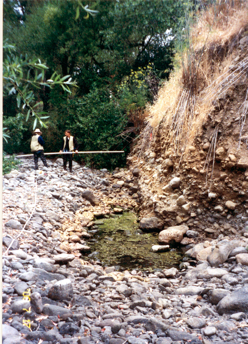
| Caption | This photo shows a baffled box culvert in a section of Carriger Creek, labeled the Grove Reach during a stream surveys in 2000. The baffles help break up stream velocities for migrating salmonids. Photo provided by Laurel Collins. |
| CaptionTemplate | [Description] |
| Category | Monitoring |
| Description | This photo shows a baffled box culvert in a section of Carriger Creek, labeled the Grove Reach during a stream surveys in 2000. The baffles help break up stream velocities for migrating salmonids. Photo provided by Laurel Collins. |
| Filename | no14grove.jpg |
| Filesize | 317275 |
| Meta_Id | Collins_son |
| Notefile | emarins.htm#collins |
| Path | topics/sc/no14grove.jpg |
| Photo Number | 5 |
| Photographer | Laurel Collins |
| Restriction | None |
| Series | Monitoring: Carriger Creek Stream Survey 2000 |
| SubBasin | Sonoma Creek |
| UpdateDate | 8/26/2006 |
| UpdateName | JEA |
| Agency | Southern Sonoma County Resource Conservation District |
| Basin | East Marin-Sonoma |
| Caption | This photo shows a shaded riparian section of Carriger Creek, labeled the Confluence Reach during stream surveys in 2000. Notice the riparian trees growing right down to the banks. Photo provided by Laurel Collins. |
| CaptionTemplate | [Description] |
| Category | Monitoring |
| Description | This photo shows a shaded riparian section of Carriger Creek, labeled the Confluence Reach during stream surveys in 2000. Notice the riparian trees growing right down to the banks. Photo provided by Laurel Collins. |
| Filename | no1neg1confluence.jpg |
| Filesize | 490243 |
| Meta_Id | Collins_son |
| Notefile | emarins.htm#collins |
| Path | topics/sc/no1neg1confluence.jpg |
| Photo Number | 6 |
| Photographer | Laurel Collins |
| Restriction | None |
| Series | Monitoring: Carriger Creek Stream Survey 2000 |
| SubBasin | Sonoma Creek |
| UpdateDate | 8/26/2006 |
| UpdateName | JEA |
| Agency | Southern Sonoma County Resource Conservation District |
| Basin | East Marin-Sonoma |
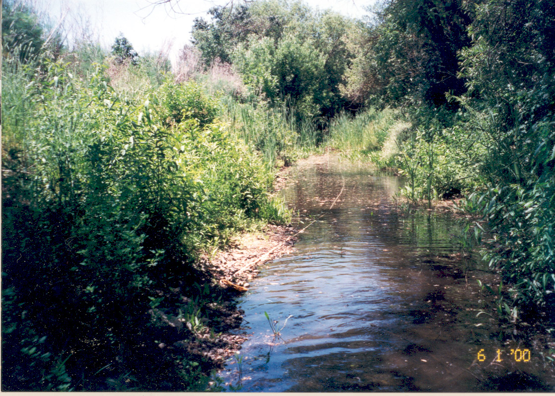
| Caption | This photo shows a section of Carriger Creek labeled the Distributary Reach during stream surveys in 2000. The cattails are indicative of stagnant, warm water. Photo provided by Laurel Collins. |
| CaptionTemplate | [Description] |
| Category | Monitoring |
| Description | This photo shows a section of Carriger Creek labeled the Distributary Reach during stream surveys in 2000. The cattails are indicative of stagnant, warm water. Photo provided by Laurel Collins. |
| Filename | no2neg19distributary.jpg |
| Filesize | 514042 |
| Meta_Id | Collins_son |
| Notefile | emarins.htm#collins |
| Path | topics/sc/no2neg19distributary.jpg |
| Photo Number | 7 |
| Photographer | Laurel Collins |
| Restriction | None |
| Series | Monitoring: Carriger Creek Stream Survey 2000 |
| SubBasin | Sonoma Creek |
| UpdateDate | 8/26/2006 |
| UpdateName | JEA |
| Agency | Southern Sonoma County Resource Conservation District |
| Basin | East Marin-Sonoma |
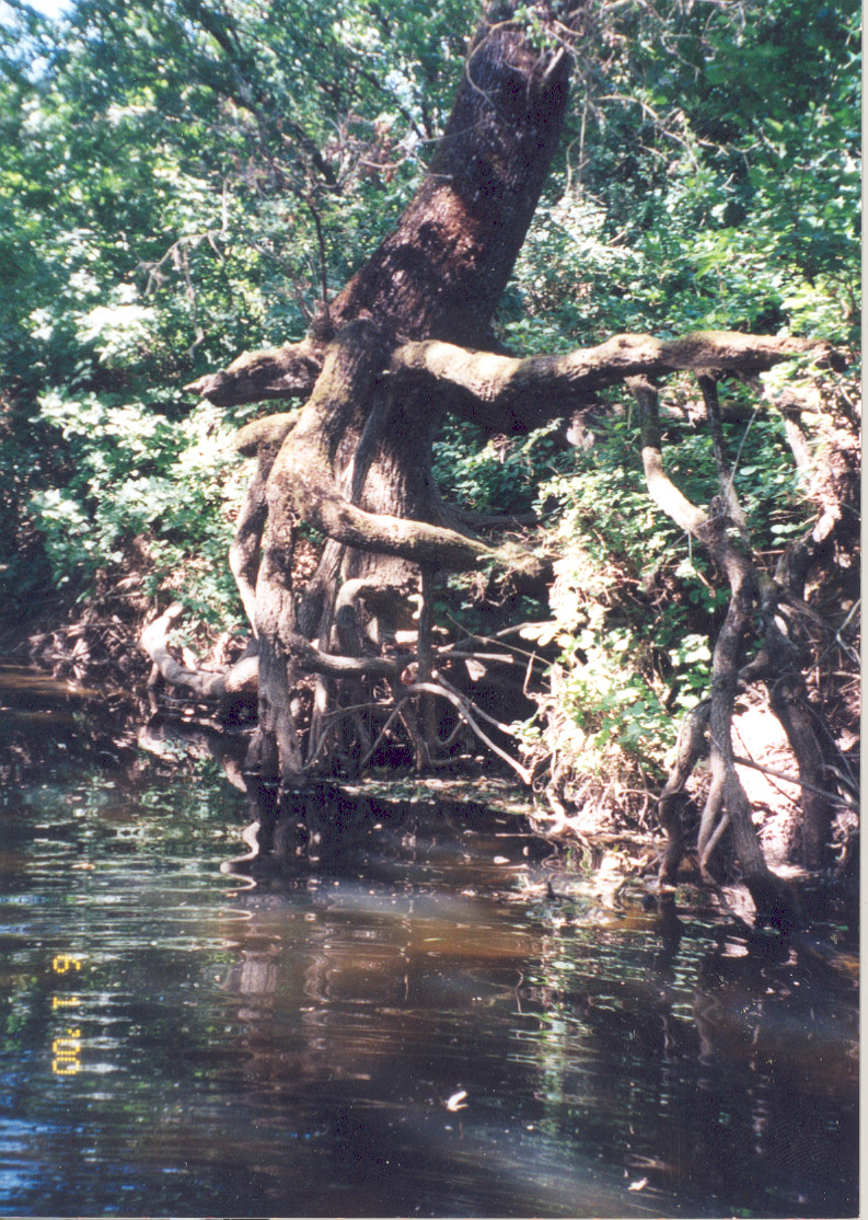
| Caption | This photo shows a section of Carriger Creek, labeled the Riparian Reach during stream surveys in 2000. The old alder root wad in the picture provides important habitat structure for juvenile steelhead. Photo provided by Laurel Collins. |
| CaptionTemplate | [Description] |
| Category | Monitoring |
| Description | This photo shows a section of Carriger Creek, labeled the Riparian Reach during stream surveys in 2000. The old alder root wad in the picture provides important habitat structure for juvenile steelhead. Photo provided by Laurel Collins. |
| Filename | no3neg23riparian.jpg |
| Filesize | 421663 |
| Meta_Id | Collins_son |
| Notefile | emarins.htm#collins |
| Path | topics/sc/no3neg23riparian.jpg |
| Photo Number | 8 |
| Photographer | Laurel Collins |
| Restriction | None |
| Series | Monitoring: Carriger Creek Stream Survey 2000 |
| SubBasin | Sonoma Creek |
| UpdateDate | 8/26/2006 |
| UpdateName | JEA |
| Agency | Southern Sonoma County Resource Conservation District |
| Basin | East Marin-Sonoma |
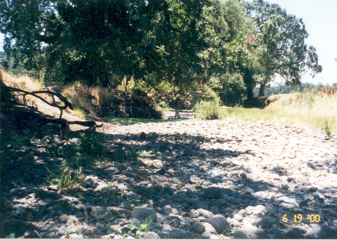
| Caption | This photo shows a degraded section of Carriger Creek, labeled the Arnold Reach during stream surveys in 2000. While the channel is shaded in the foreground, the wide stream bed is highly aggraded with sorted cobble material and lacks salmonid habitat features. Photo provided by Laurel Collins. |
| CaptionTemplate | [Description] |
| Category | Monitoring |
| Description | This photo shows a degraded section of Carriger Creek, labeled the Arnold Reach during stream surveys in 2000. While the channel is shaded in the foreground, the wide stream bed is highly aggraded with sorted cobble material and lacks salmonid habitat features. Photo provided by Laurel Collins. |
| Filename | no4neg23quercus.jpg |
| Filesize | 476661 |
| Meta_Id | Collins_son |
| Notefile | emarins.htm#collins |
| Path | topics/sc/no4neg23quercus.jpg |
| Photo Number | 8 |
| Photographer | Laurel Collins |
| Restriction | None |
| Series | Monitoring: Carriger Creek Stream Survey 2000 |
| SubBasin | Sonoma Creek |
| UpdateDate | 8/26/2006 |
| UpdateName | JEA |
| Agency | Southern Sonoma County Resource Conservation District |
| Basin | East Marin-Sonoma |
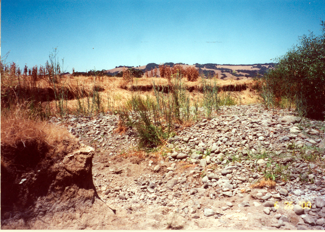
| Caption | This photo shows a degraded section of Carriger Creek, labeled the Few Oaks Reach during stream surveys in 2000. Notice the high, eroding bank in the background. The channel appears aggraded with sand material. Photo provided by Laurel Collins. |
| CaptionTemplate | [Description] |
| Category | Monitoring |
| Description | This photo shows a degraded section of Carriger Creek, labeled the Few Oaks Reach during stream surveys in 2000. Notice the high, eroding bank in the background. The channel appears aggraded with sand material. Photo provided by Laurel Collins. |
| Filename | no5neg24fewoaks.jpg |
| Filesize | 409915 |
| Meta_Id | Collins_son |
| Notefile | emarins.htm#collins |
| Path | topics/sc/no5neg24fewoaks.jpg |
| Photo Number | 9 |
| Photographer | Laurel Collins |
| Restriction | None |
| Series | Monitoring: Carriger Creek Stream Survey 2000 |
| SubBasin | Sonoma Creek |
| UpdateDate | 8/26/2006 |
| UpdateName | JEA |
| Agency | Southern Sonoma County Resource Conservation District |
| Basin | East Marin-Sonoma |
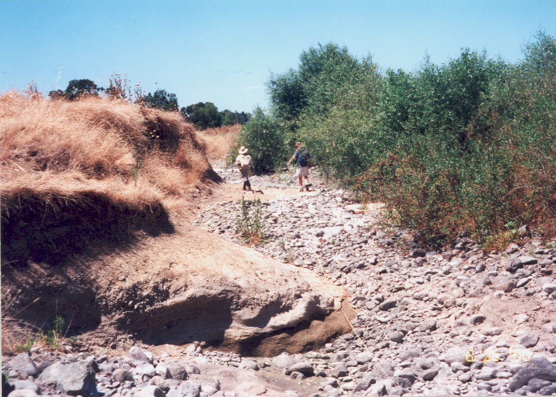
| Caption | This photo shows a degraded section of Carriger Creek, labeled the Denuded Reach during stream surveys in 2000. Sorted cobble material is piled high in the foreground while eroded banks line the channel. Photo provided by Laurel Collins. |
| CaptionTemplate | [Description] |
| Category | Monitoring |
| Description | This photo shows a degraded section of Carriger Creek, labeled the Denuded Reach during stream surveys in 2000. Sorted cobble material is piled high in the foreground while eroded banks line the channel. Photo provided by Laurel Collins. |
| Filename | no6neg17denuded.jpg |
| Filesize | 438312 |
| Meta_Id | Collins_son |
| Notefile | emarins.htm#collins |
| Path | topics/sc/no6neg17denuded.jpg |
| Photo Number | 11 |
| Photographer | Laurel Collins |
| Restriction | None |
| Series | Monitoring: Carriger Creek Stream Survey 2000 |
| SubBasin | Sonoma Creek |
| UpdateDate | 8/26/2006 |
| UpdateName | JEA |
| Agency | Southern Sonoma County Resource Conservation District |
| Basin | East Marin-Sonoma |
| Caption | This photo shows a degraded section of Carriger Creek, labeled the Shamrock Reach during stream surveys in 2000. The green willow thicket is a contrast to the aggraded cobble channel and high, eroding banks. Photo provided by Laurel Collins. |
| CaptionTemplate | [Description] |
| Category | Monitoring |
| Description | This photo shows a degraded section of Carriger Creek, labeled the Shamrock Reach during stream surveys in 2000. The green willow thicket is a contrast to the aggraded cobble channel and high, eroding banks. Photo provided by Laurel Collins. |
| Filename | no7neg24shamrock.jpg |
| Filesize | 407496 |
| Meta_Id | Collins_son |
| Notefile | emarins.htm#collins |
| Path | topics/sc/no7neg24shamrock.jpg |
| Photo Number | 12 |
| Photographer | Laurel Collins |
| Restriction | None |
| Series | Monitoring: Carriger Creek Stream Survey 2000 |
| SubBasin | Sonoma Creek |
| UpdateDate | 8/26/2006 |
| UpdateName | JEA |
| Agency | Southern Sonoma County Resource Conservation District |
| Basin | East Marin-Sonoma |
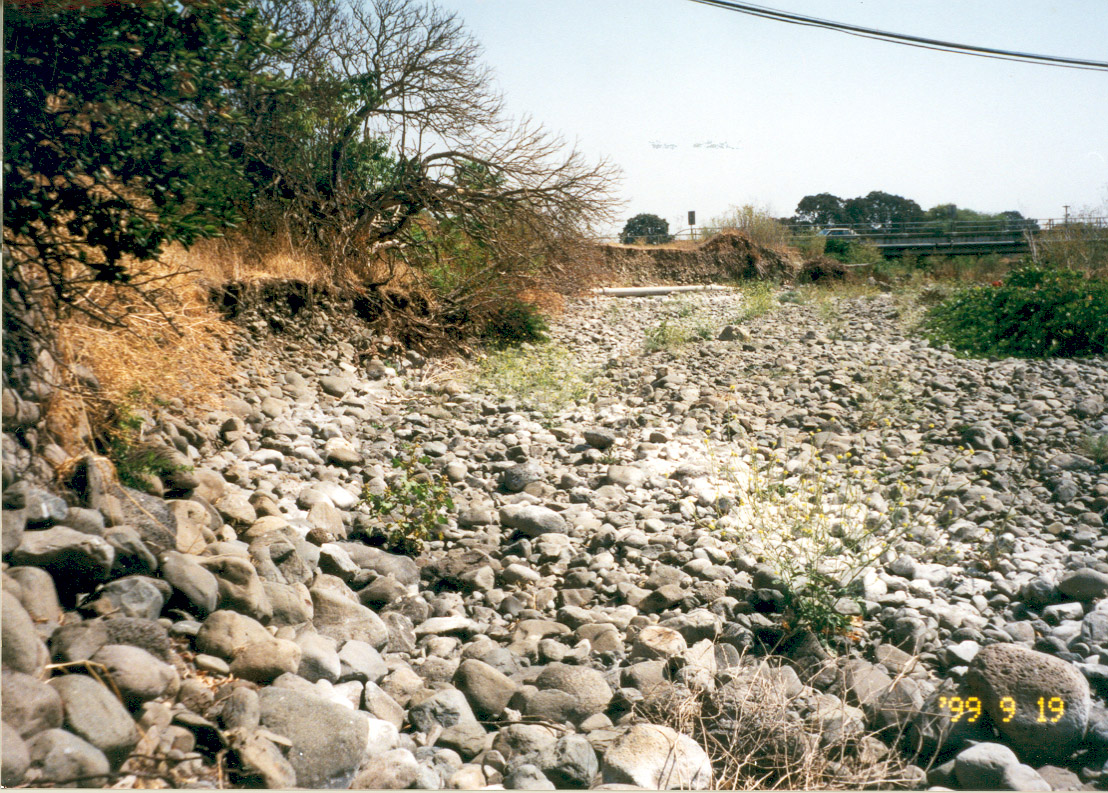
| Caption | This photo shows a degraded section of Carriger Creek, labeled the Arnold Reach during stream surveys in 2000. The stream appears highly aggraded with large cobble material. Notice the cut banks in the background. Photo provided by Laurel Collins. |
| CaptionTemplate | [Description] |
| Category | Monitoring |
| Description | This photo shows a degraded section of Carriger Creek, labeled the Arnold Reach during stream surveys in 2000. The stream appears highly aggraded with large cobble material. Notice the cut banks in the background. Photo provided by Laurel Collins. |
| Filename | no8pg26arnold.jpg |
| Filesize | 454059 |
| Meta_Id | Collins_son |
| Notefile | emarins.htm#collins |
| Path | topics/sc/no8pg26arnold.jpg |
| Photo Number | 13 |
| Photographer | Laurel Collins |
| Restriction | None |
| Series | Monitoring: Carriger Creek Stream Survey 2000 |
| SubBasin | Sonoma Creek |
| UpdateDate | 8/26/2006 |
| UpdateName | JEA |
| Agency | Southern Sonoma County Resource Conservation District |
| Basin | East Marin-Sonoma |
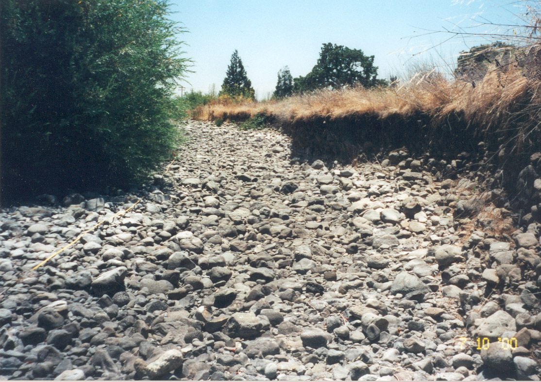
| Caption | This photo shows a degraded section of Carriger Creek, labeled the Few Willows Reach during stream surveys in 2000. Sorted large cobble material dominate the aggraded channel. Willows to the left contrast the cut banks on the right. Photo provided by Laurel Collins. |
| CaptionTemplate | [Description] |
| Category | Monitoring |
| Description | This photo shows a degraded section of Carriger Creek, labeled the Few Willows Reach during stream surveys in 2000. Sorted large cobble material dominate the aggraded channel. Willows to the left contrast the cut banks on the right. Photo provided by Laurel Collins. |
| Filename | no9neg13fewwillows.jpg |
| Filesize | 386678 |
| Meta_Id | Collins_son |
| Notefile | emarins.htm#collins |
| Path | topics/sc/no9neg13fewwillows.jpg |
| Photo Number | 14 |
| Photographer | Laurel Collins |
| Restriction | None |
| Series | Monitoring: Carriger Creek Stream Survey 2000 |
| SubBasin | Sonoma Creek |
| UpdateDate | 8/26/2006 |
| UpdateName | JEA |
| www.krisweb.com |