 179 KB
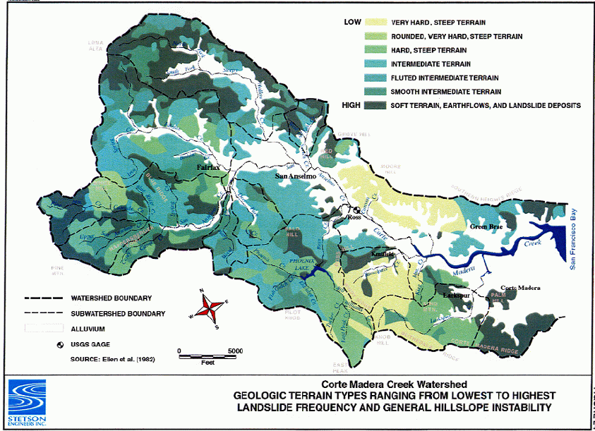
This image reflects hillslope instability by geologic terrain type within the Corte Madera watershed. The figure is from Stetson Engineers, Inc. (2000).
 143 KB
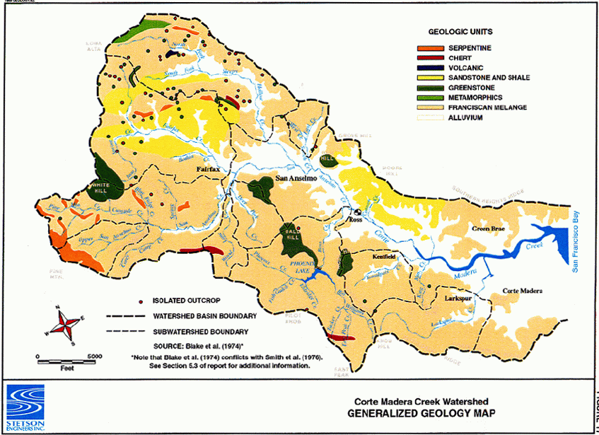
This image shows the dominate geological formations in the Corte Madera watershed. The figure is from Stetson Engineers, Inc. (2000).
 191 KB
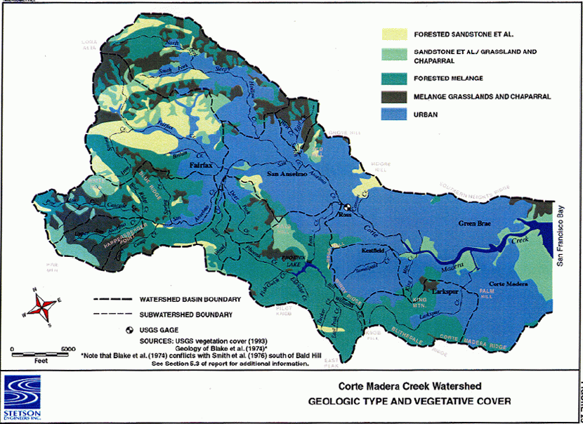
This image relates vegetation cover and geological formation type within the Corte Madera watershed. The figure is from Stetson Engineers, Inc. (2000).
 152 KB
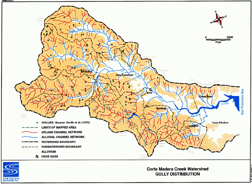
This image shows the locations of gully erosion sources within the Corte Madera Creek watershed. The figure is from Stetson Engineers, Inc. (2000).
 148 KB
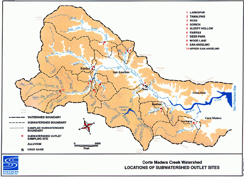
This image show sample sites used during the Stetson Engineers, Inc (2000) "Geomorphic Assessment of the Corte Madera Creek Watershed".
 148 KB
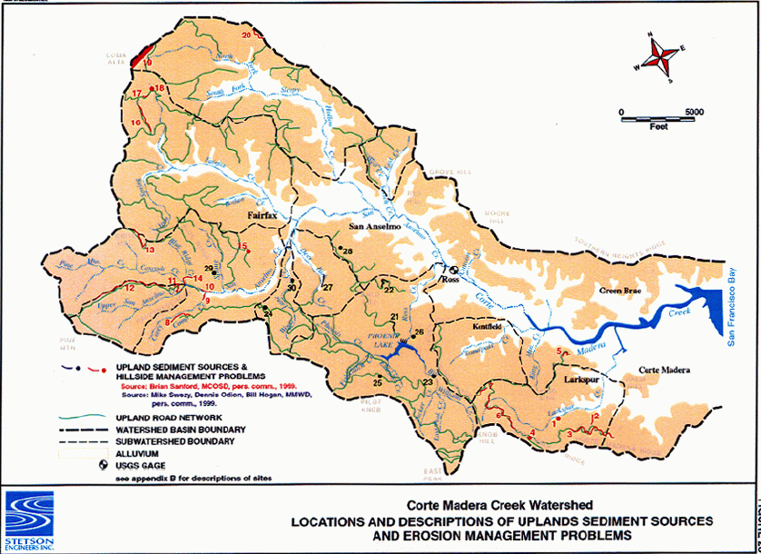
This image shows the locations of active sediment sources within the Corte Madera Creek watershed. The figure is from Stetson Engineers, Inc. (2000).
 149 KB
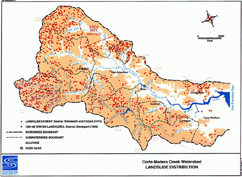
This image shows the locations of landslides within the Corte Madera Creek watershed. The figure is from Stetson Engineers, Inc. (2000).