Area/Topic  |  Bibliography   |  Background   |  Hypotheses   |  Home


Photo Pages.
Photos on this page are from sub-basin Novato and Miller Creeks and series Monitoring: Maps of Erosion Inventory Novato Creek 2001.

For a list of photo pages sorted by series, click here. For a list of photo pages sorted by sub-basin, click here.

Click on any thumbnail to see a larger photo. For detailed information on these photos click here.

../topics/nm/pci_novato_erosionmap1.jpg + 604 KB   604 KB
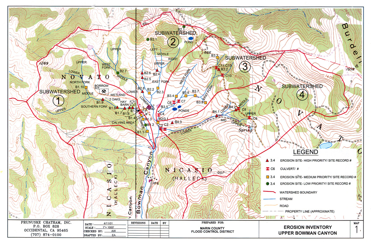
This map show the results of an erosion inventory conducted in Upper Bowman Canyon, in the Novato Creek watershed, during 2001. Image provided courtesy of Prunuske Chatham Inc. and the Marin County Department of Public Works (PCI 2001).

../topics/nm/pci_novato_erosionmap2.jpg + 605 KB   605 KB
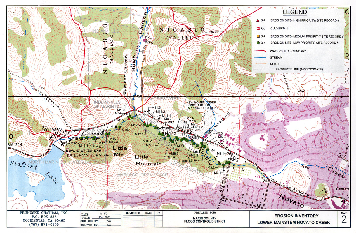
This map show the results of an erosion inventory conducted along lower mainstem Novato Creek during 2001. Image provided courtesy of Prunuske Chatham Inc. and the Marin County Department of Public Works (PCI 2001).


  www.krisweb.com