 152 KB
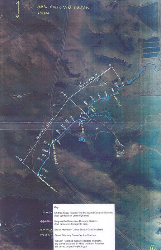
This aerial shows the Highway and Ditch reach locations along San Antonio Creek. Note the Key box at the bottom of the image describes the handwritten information. The photo was taken from Collins, 2000.
 456 KB
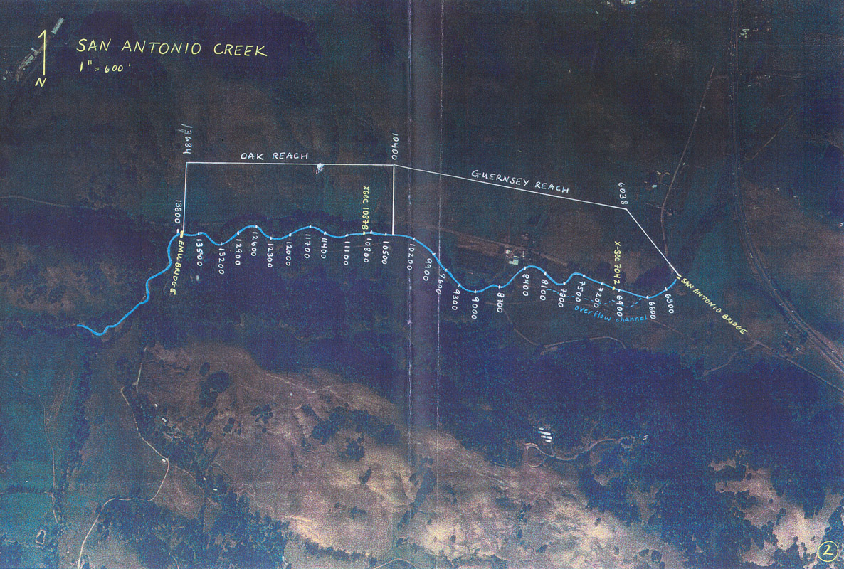
This aerial shows the Oak and Guernsey reach locations along San Antonio Creek. Note the Key box at the bottom of aerial #1 describes the handwritten information. The photo was taken from Collins, 2000.
 456 KB
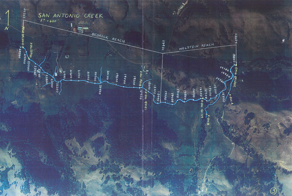
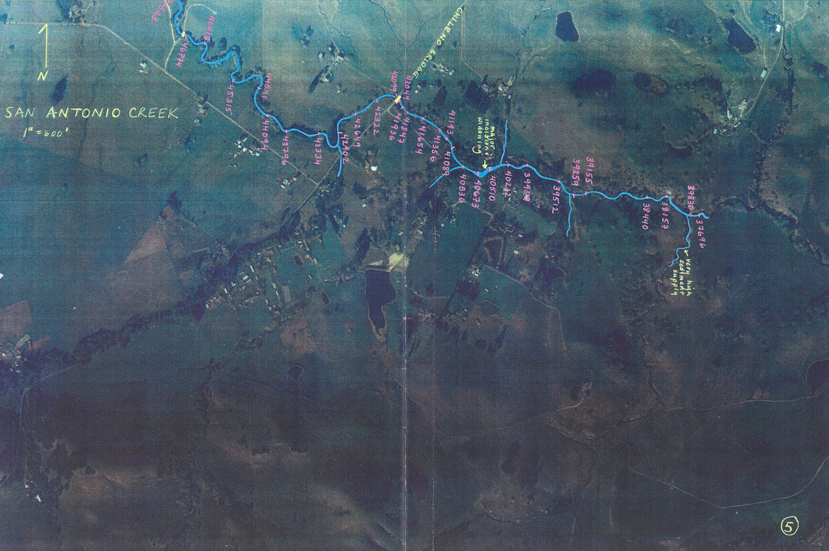
This aerial shows the Bedrock and Holstein reach locations along San Antonio Creek. Note the Key box at the bottom of aerial #1 describes the handwritten information. The photo was taken from Collins, 2000.
 421 KB
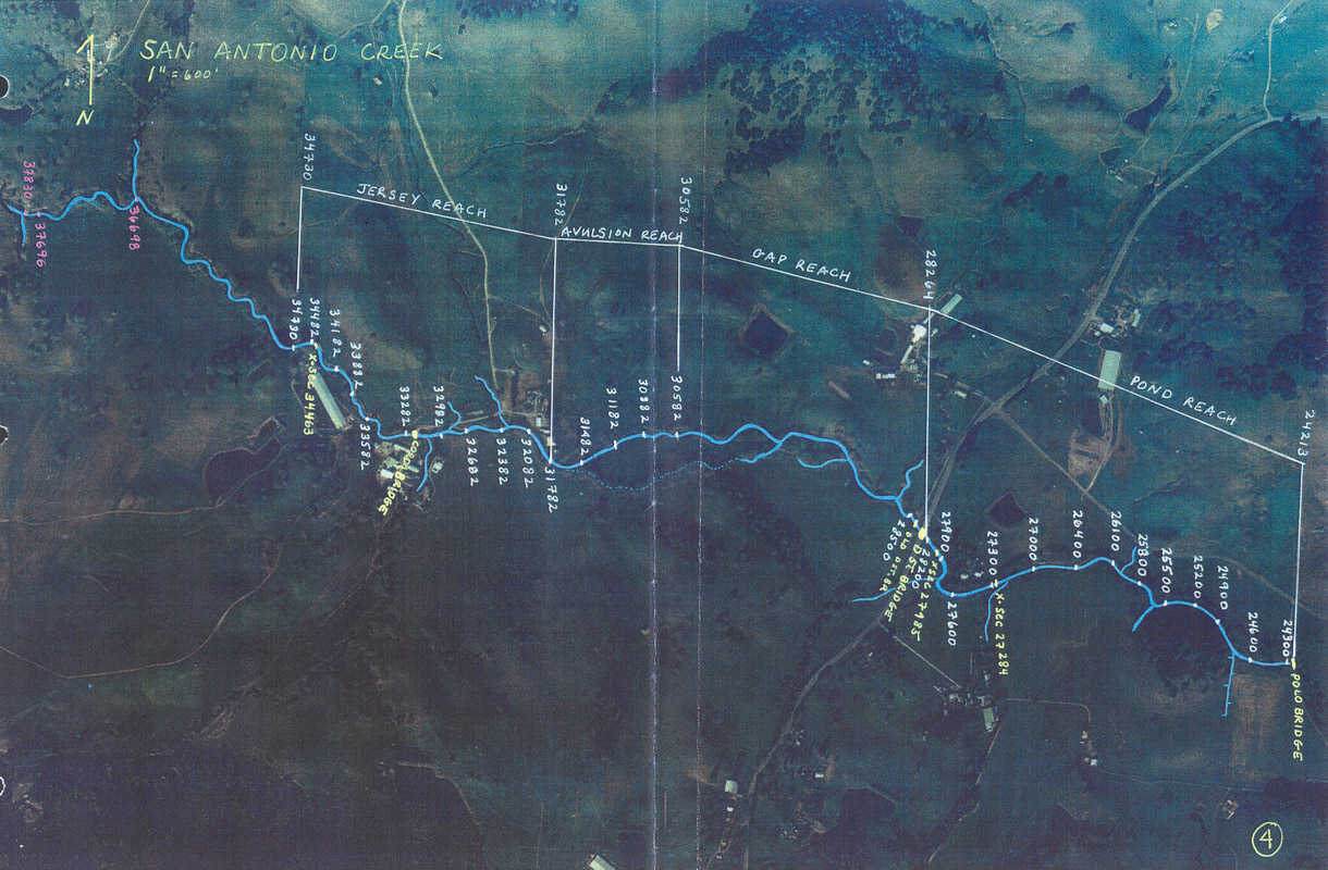
This aerial shows the Jersey, Avulsion, Gap, and Pond reach locations along San Antonio Creek. Note the Key box at the bottom of aerial #1 describes the handwritten information. The photo was taken from Collins, 2000.
 410 KB
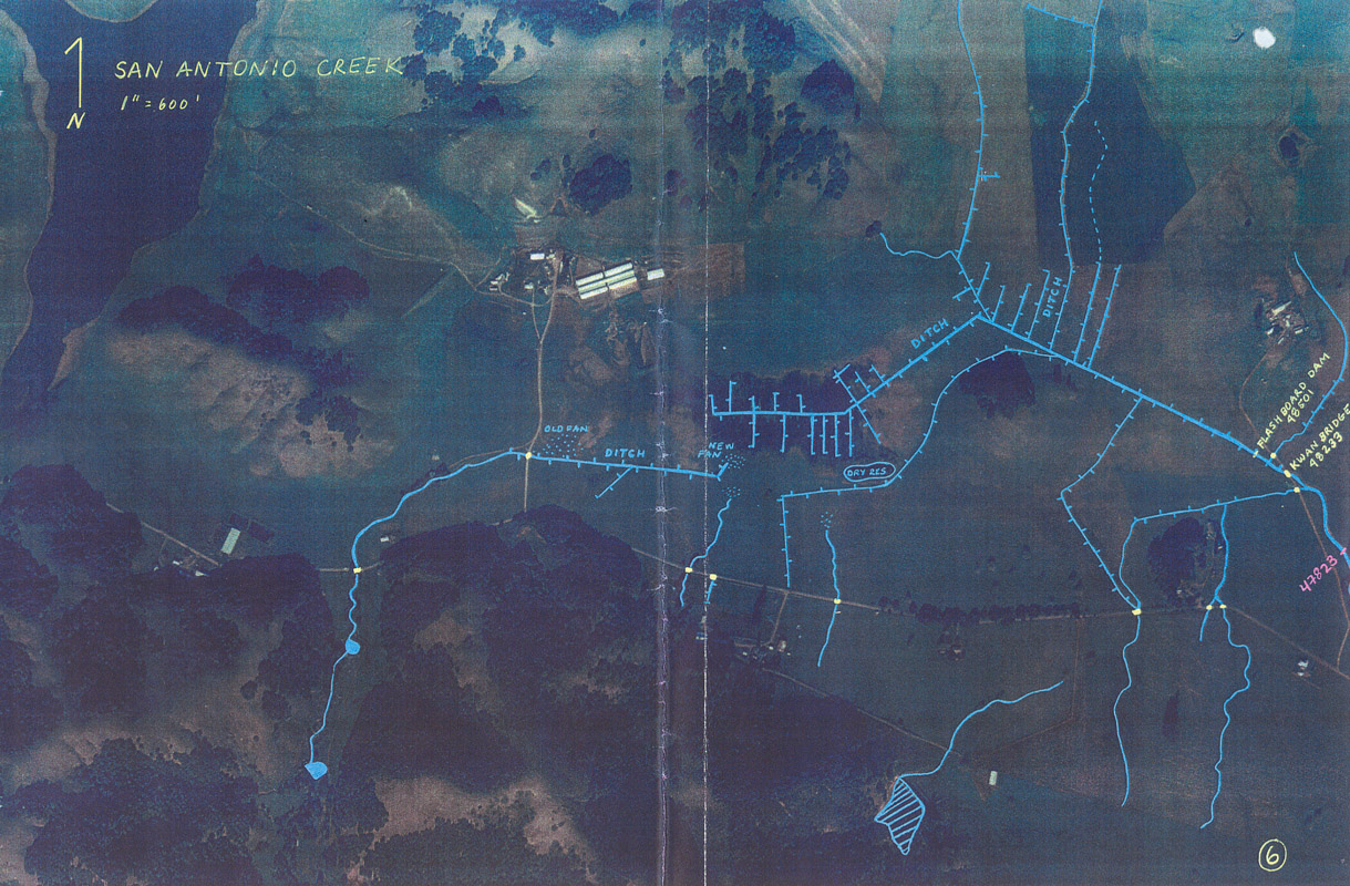
This aerial shows the area upstream of the study reaches in San Antonio Creek. Note the Key box at the bottom of aerial #1 describes the handwritten information. The photo was taken from Collins, 2000.
 415 KB
This aerial shows the continuation of San Antonio Creek upstream of the study reaches. Note the Key box at the bottom of aerial #1 describes the handwritten information. The photo was taken from Collins, 2000.