| Area |
Arroyo Corte Madera |
| Topic |
Land Cover: EPA Land-Use, Arroyo Corte Madera 1992 |
|
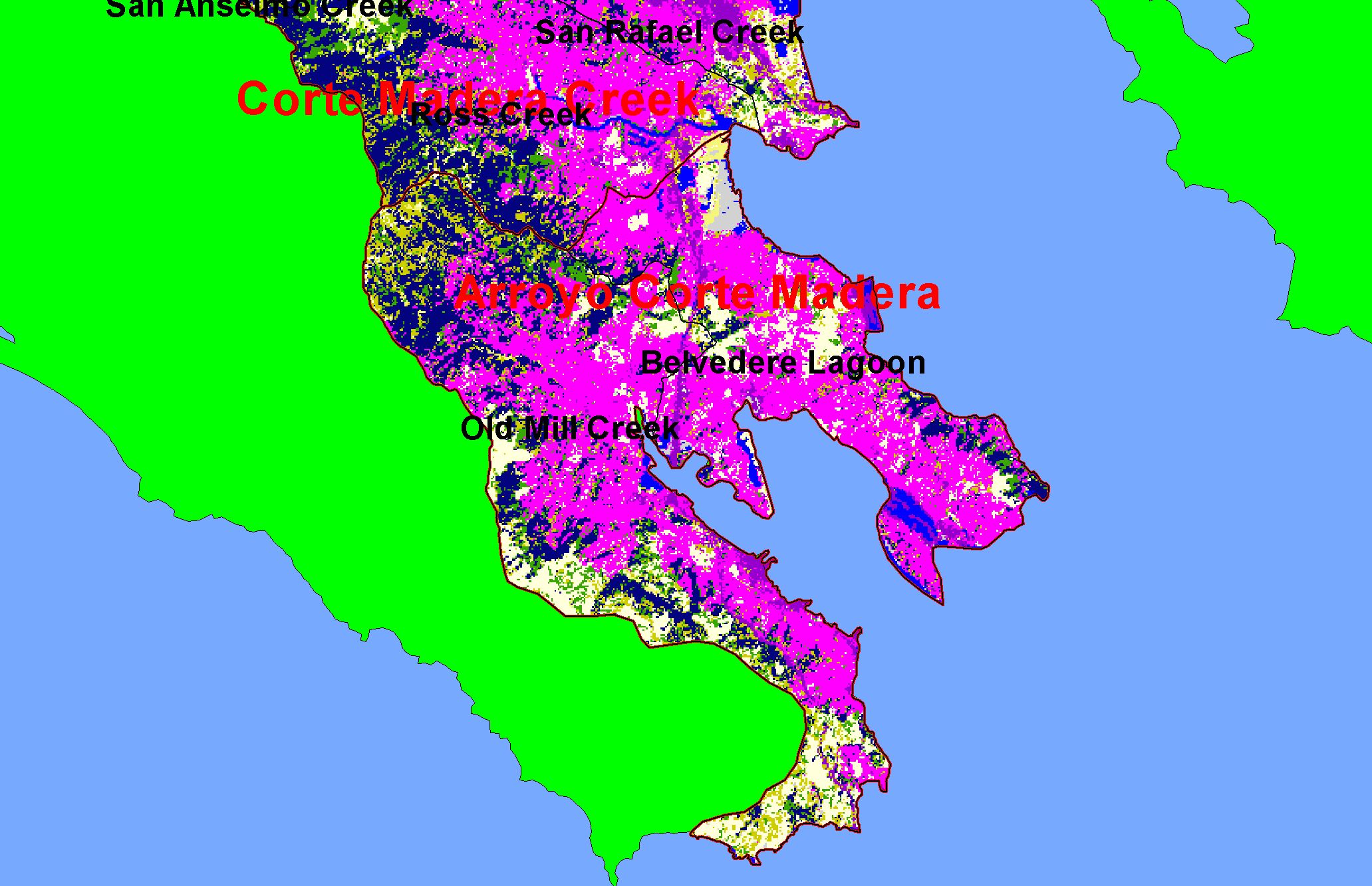
This is a map of EPA Landcover/Landuse in Calwater Planning Watersheds in the Arroyo Corte Madera sub-basin, based on a 1992 Landsat TM satellite image.
Residential (hot pink), along with some commercial-industrial (purple), almost completely covered the flat areas and extend into the hills. Patches of coniferous forest
(blue) and mixed forest (dark green) remain on the upper slopes. Data were provided by the U.S. Environmental Protection Agency.
|
|
|
 |
 |
To view metadata about a map layer, click on a link in the table below.
| Name of Layer in Map Legend | Metadata File Name |
|---|
| Calwater PWS (w/ labels) | calw22.shp.txt |
| Subbasins (w/ labels) | subbasins.shp.txt |
| Frame Project Outline | Unavailable |
| EPA Landcover (1992 Aggregated) | lndcov2.tif.txt |
| Project Area Background | Unavailable |
If you obtain KRIS on a CD and install it on your hard drive as a desktop program, you will have access to increased map capabilities such as zooming in/out, turning layers on/off, adding layers and changing legends.
