| Area |
Arroyo Corte Madera |
| Topic |
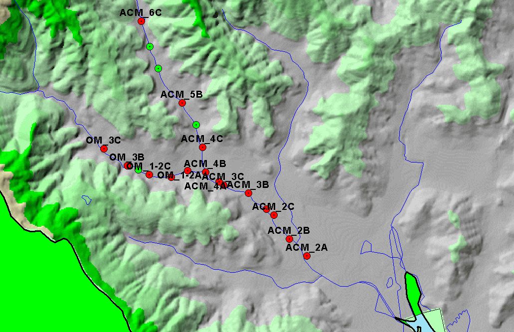
Map: 2A. Arroyo Corte Madera Habitat Survey Pts, Hotlinked to Photos |
|
This is a map of 1996-1997 habitat survey points in the Arroyo Corte Madera watershed, displayed on top of 1:24,000 scale streams and an elevation hillshade. Sites
labeled "ACM" are on Arroyo Corte Madera Creek and sites labeled "OM" are on Old Mill Creek. Points shown in red are hotlinked to photo tours. To view a site
photo, click on a red dot.
|
|
|
 |
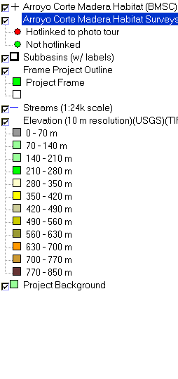 |
To view metadata about a map layer, click on a link in the table below.
| Name of Layer in Map Legend | Metadata File Name |
|---|
| Arroyo Corte Madera Habitat (BMSC) (labels) | Unavailable |
| Arroyo Corte Madera Habitat Surveys (BMSC) | Unavailable |
| Subbasins (w/ labels) | subbasins.shp.txt |
| Frame Project Outline | Unavailable |
| Streams (1:24k scale) | streams24.shp.txt |
| Elevation (10 m resolution)(USGS)(TIFF) | elev10.tif.txt |
| Project Background | Unavailable |
If you obtain KRIS on a CD and install it on your hard drive as a desktop program, you will have access to increased map capabilities such as zooming in/out, turning layers on/off, adding layers and changing legends.
