| Area |
Regional |
| Topic |
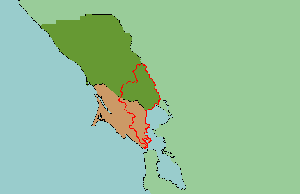
Map: 1A. Project Location of East Marin-Sonoma |
To view a more detailed version of this map click
here
|
This is a map of the regional location of the KRIS East Marin-Sonoma project area (red outline). The project area is composed of all the watersheds in Sonoma and
Marin Counties that drain into San Francisco Bay and San Pablo Bay. In other words, it is the area between the Golden Gate and the Napa River. Scale = 1:1,160,294 .
|
|
|
 |
 |
To view metadata about a map layer, click on a link in the table below.
| Name of Layer in Map Legend | Metadata File Name |
|---|
| KRIS Project Outline | Unavailable |
| Pacific Ocean | Unavailable |
| Counties | Unavailable |
| California | Unavailable |
If you obtain KRIS on a CD and install it on your hard drive as a desktop program, you will have access to increased map capabilities such as zooming in/out, turning layers on/off, adding layers and changing legends.
