| Area |
Regional |
| Topic |
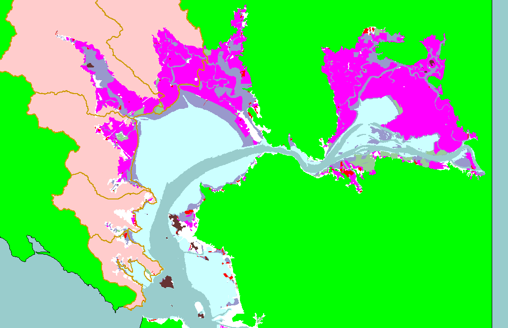
Map: 1K. Tidal Wetlands, East Marin-Sonoma |
To view a more detailed version of this map click
here
|
This is a map of the tidal wetlands in the KRIS East Marin-Sonoma project and surrounding area, overlaid on top of the KRIS East Marin-Sonoma project
background. Baylands layers were provided by EcoAtlas, San Francisco Estuary Institute (SFEI), Oakland California, 1997. Extensive areas of the historical bay
have been diked (pink) and filled (red). Data were provided by the San Francisco Ecosystem Institute.
|
|
|
 |
 |
To view metadata about a map layer, click on a link in the table below.
| Name of Layer in Map Legend | Metadata File Name |
|---|
| Subbasins (no labels) | subbasins.shp.txt |
| Modern Baylands (SFEI) (Broad legend) | mbypsfby.shp.txt |
| Frame Project Outline | Unavailable |
| Project Background | Unavailable |
If you obtain KRIS on a CD and install it on your hard drive as a desktop program, you will have access to increased map capabilities such as zooming in/out, turning layers on/off, adding layers and changing legends.
