| Area |
Regional |
| Topic |
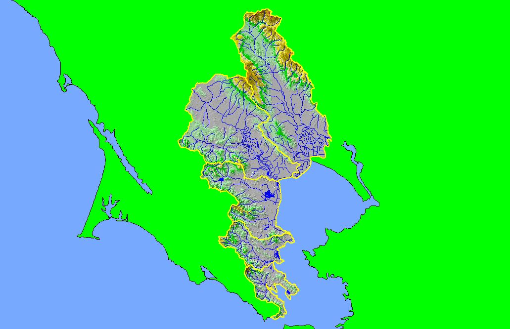
Map: 1D. Hydrography with DEM, East Marin-Sonoma |
To view a more detailed version of this map click
here
|
This is a map of the 1:100,000 scale U.S. Geologic Survey hydrography in the KRIS East Marin-Sonoma project area overlaid on top of a Digital Elevation Model
(DEM) showing the topography of the landscape. Much of the project area is low relief, except for the most northern portion. Sonoma Mountain lies between upper
Sonoma Creek and the upper Petaluma River. The most mountainous area in the project is the northeastern Sonoma Creek watershed, which includes Red
Mountain, Bald Mountain, and Mount Veeder.
|
|
|
 |
 |
To view metadata about a map layer, click on a link in the table below.
| Name of Layer in Map Legend | Metadata File Name |
|---|
| Subbasins (no labels) | subbasins.shp.txt |
| Streams (1:100k scale)(no labels) | streams100.shp.txt |
| Frame Project Outline | Unavailable |
| Lakes and Reservoirs (Marin only) | Unavailable |
| Elevation (10 m resolution)(USGS)(TIFF) | elev10.tif.txt |
If you obtain KRIS on a CD and install it on your hard drive as a desktop program, you will have access to increased map capabilities such as zooming in/out, turning layers on/off, adding layers and changing legends.
