
| Area | Corte Madera Creek |
| Topic | Climate: Annual Rainfall in the San Rafael Creek Calwater 1914-1938 |
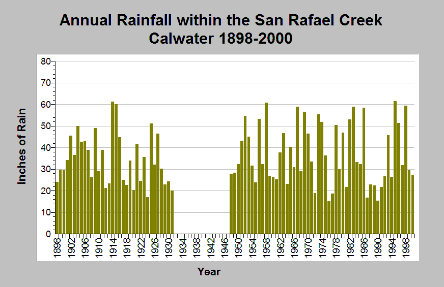
| Caption: This chart shows annual rainfall totals recorded at the San Rafael raingage (DWR gage # E20 7880 00) between 1898 and 2000, missing 1932-1947. This raingage is located within the San Rafael Creek Calwater planning watershed in the Corte Madera Creek sub-basin. The reported rainfall data are point measurements and do not represent the spatial variations existing throughout the entire Calwater planning watershed or the Corte Madera Creek sub-basin. See Info Links for more information. | |
 |
To learn more about this topic click Info Links .
To view additional information (data source, aquisition date etc.) about this page, click Metadata .
To view the table with the chart's data, click Chart Table web page.
To download the table with the chart's data, click climate_rainfall_northbay_cdwr_1874_2002.dbf (size 45,144 bytes)
To download the table with the chart's data as an Excel spreadsheet, click climate_rainfall_northbay_cdwr_1874_2002.dbf.xls (size 26,332 bytes) .
| www.krisweb.com |