| Area |
Corte Madera Creek |
| Topic |
Tour: Historical Flooding Corte Madera Cr 1927, 1966, 1982, and 1986 |
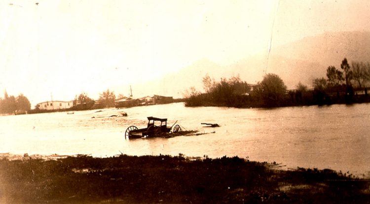
 Click on image to enlarge (43K). Click here to display a larger version (181K).
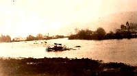
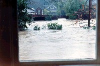
This image shows flooding in Kentfield during 1927. Photo provided by the U.S. Army Corps of Engineers.
 Click on image to enlarge (47K). Click here to display a larger version (259K).
This image shows flooding in Kentfield during 1982. Photo provided by the U.S. Army Corps of Engineers.
 Click on image to enlarge (75K).
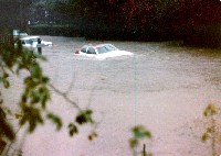
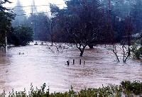
This image shows flooding in Granton Park during 1966. Photo provided by the U.S. Army Corps of Engineers.
 Click on image to enlarge (69K).
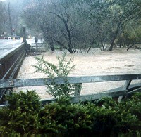
This image shows flooding in Hillview Gardens during 1966. Photo provided by the U.S. Army Corps of Engineers.
 Click on image to enlarge (65K). Click here to display a larger version (217K).
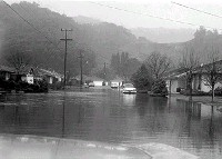
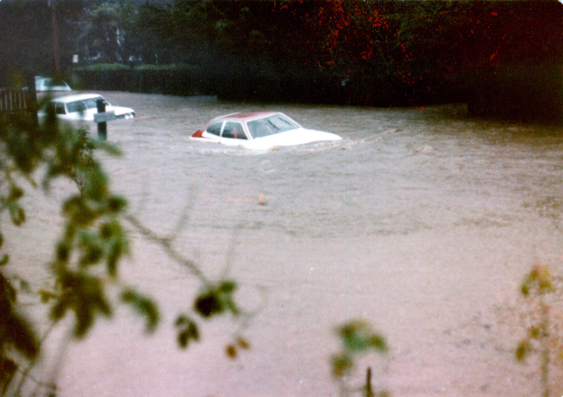
This image shows flooding in Ross during 1982. Photo provided by the U.S. Army Corps of Engineers.
 Click on image to enlarge (78K). Click here to display a larger version (266K).
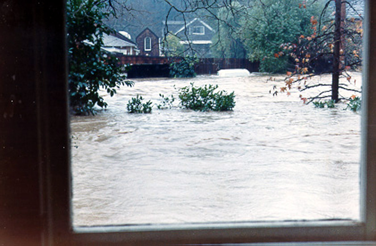
This image shows flooding along Kent Avenue in Ross during 1982. Photo provided by the U.S. Army Corps of Engineers.
 Click on image to enlarge (165K).
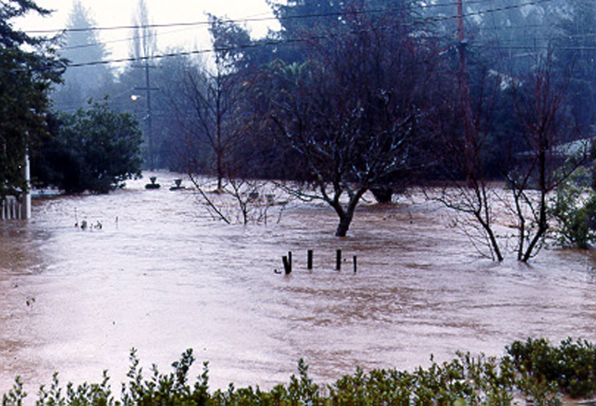
This image shows flooding in Ross during 1986. Photo provided by the U.S. Army Corps of Engineers.
 Click on image to enlarge (67K). Click here to display a larger version (184K).
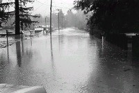
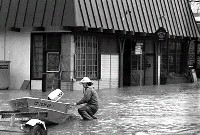
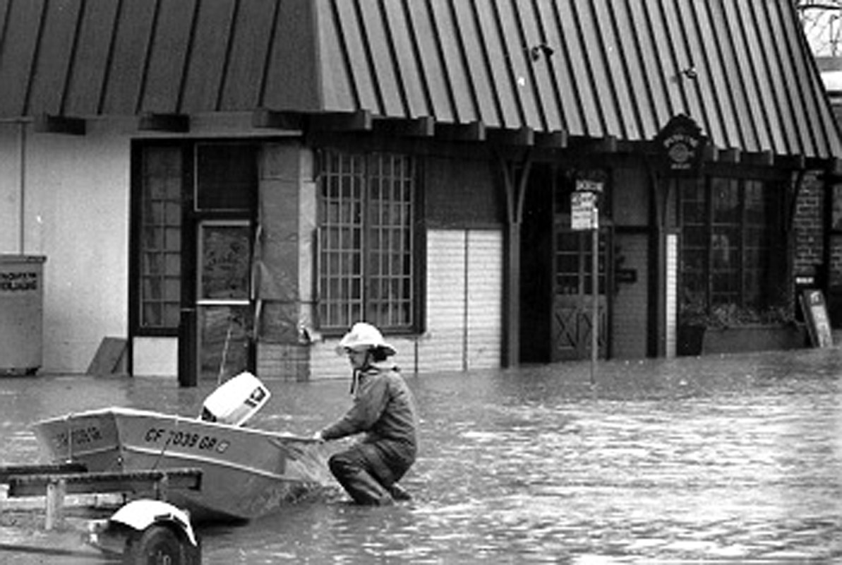
This image shows flooding along College Avenue during 1982. Photo provided by the U.S. Army Corps of Engineers.
To learn more about this topic click Info Links
To view additional information (data source, aquisition date etc.) about this page, click Metadata

 Click on image to enlarge (43K). Click here to display a larger version (181K).
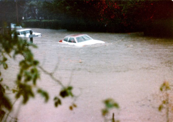 Click on image to enlarge (47K). Click here to display a larger version (259K).
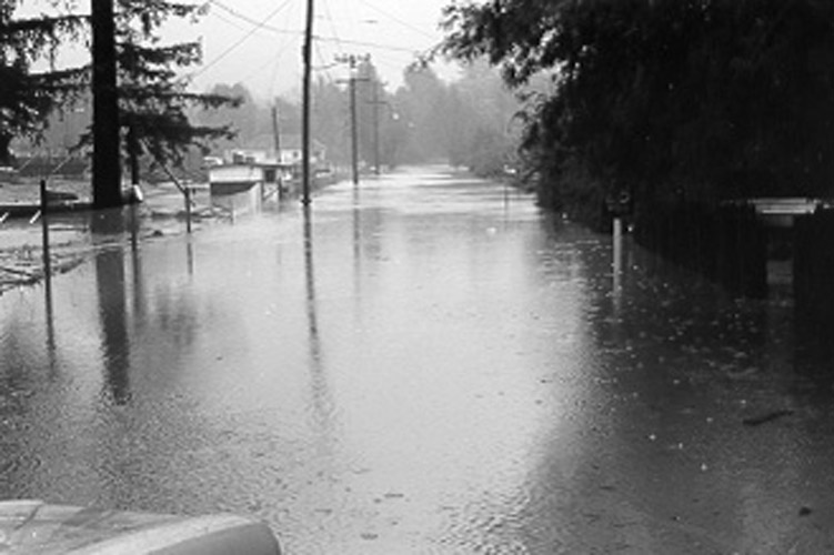 Click on image to enlarge (75K).
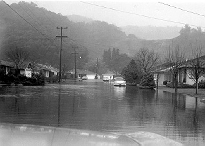 Click on image to enlarge (69K).
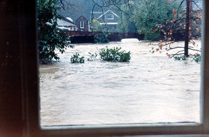 Click on image to enlarge (65K). Click here to display a larger version (217K).
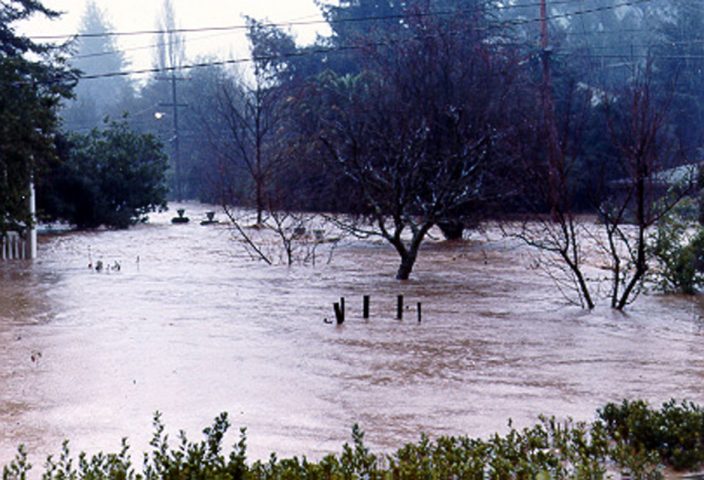 Click on image to enlarge (78K). Click here to display a larger version (266K).
 Click on image to enlarge (165K).
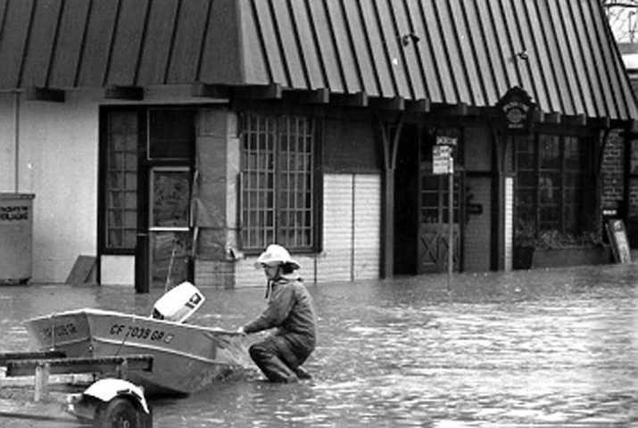 Click on image to enlarge (67K). Click here to display a larger version (184K).
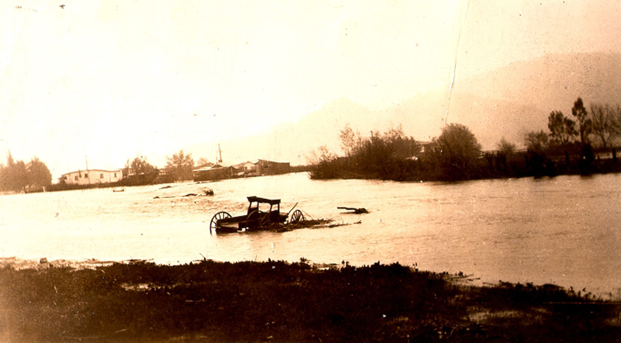