
| Area | Corte Madera Creek |
| Topic | Sediment: Bedload Estimates for Subwatersheds in Corte Madera Cr 1999 |
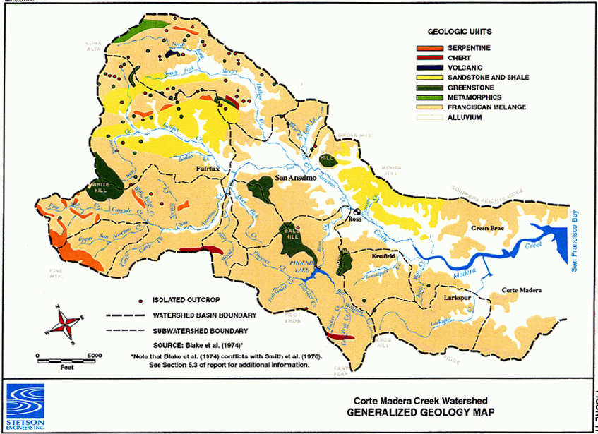
This image shows the dominate geological formations in the Corte Madera watershed. The figure is from Stetson Engineers, Inc. (2000).
This image relates vegetation cover and geological formation type within the Corte Madera watershed. The figure is from Stetson Engineers, Inc. (2000).
This image reflects hillslope instability by geologic terrain type within the Corte Madera watershed. The figure is from Stetson Engineers, Inc. (2000).
This image shows the locations of landslides within the Corte Madera Creek watershed. The figure is from Stetson Engineers, Inc. (2000).
This image shows the locations of gully erosion sources within the Corte Madera Creek watershed. The figure is from Stetson Engineers, Inc. (2000).
This image shows the locations of active sediment sources within the Corte Madera Creek watershed. The figure is from Stetson Engineers, Inc. (2000).
 Click on image to enlarge (144K).
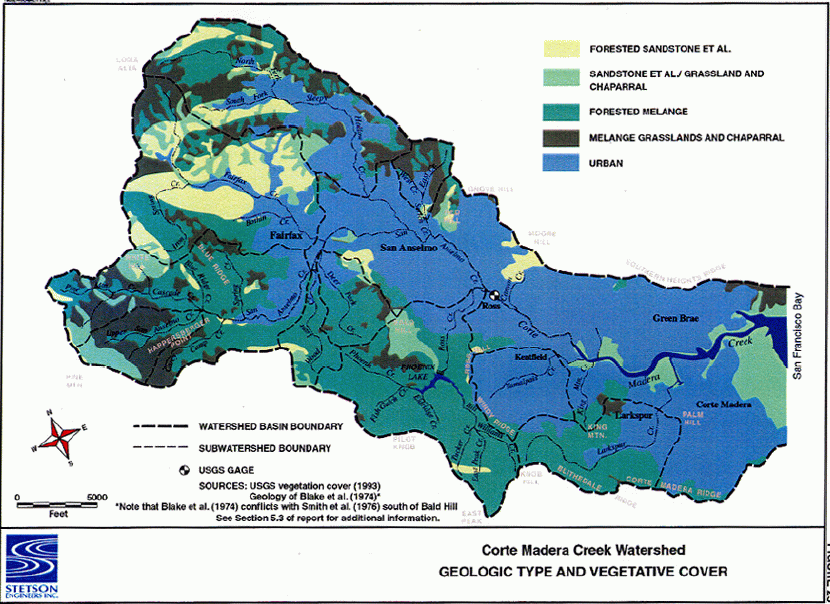 Click on image to enlarge (192K).
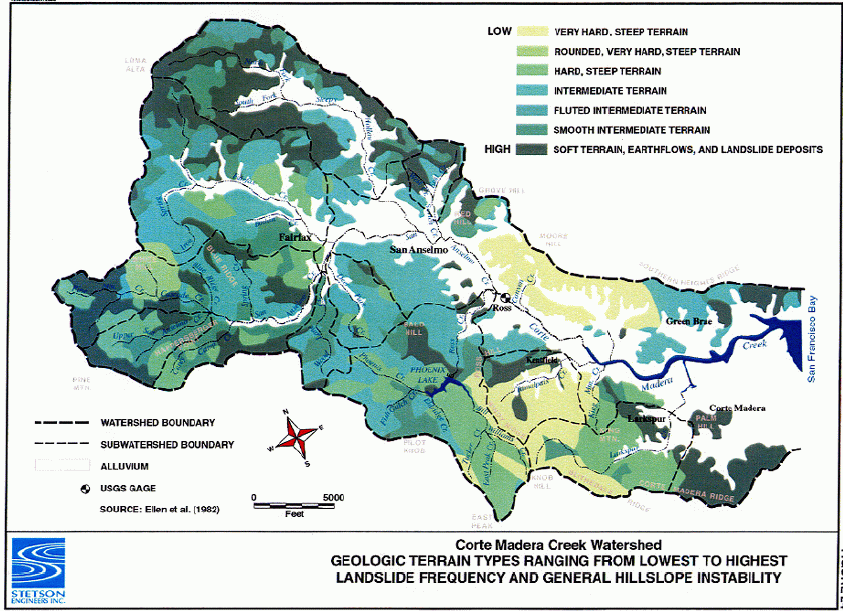 Click on image to enlarge (180K).
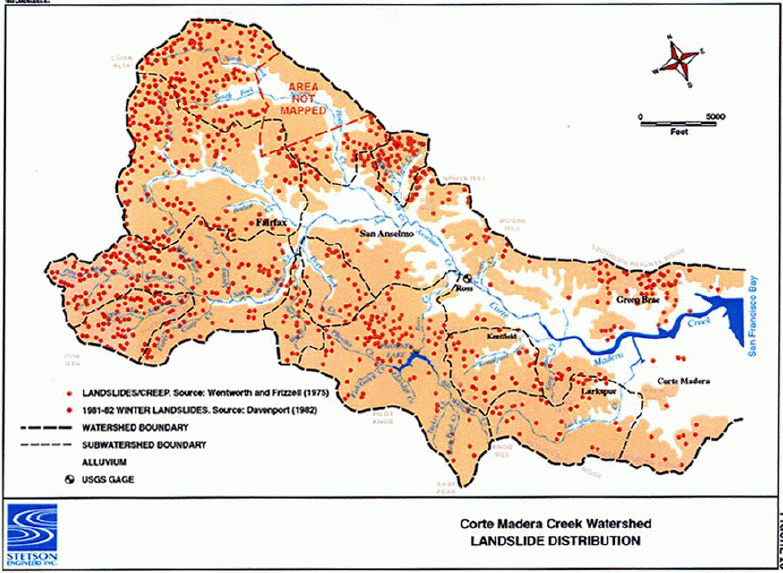 Click on image to enlarge (149K).
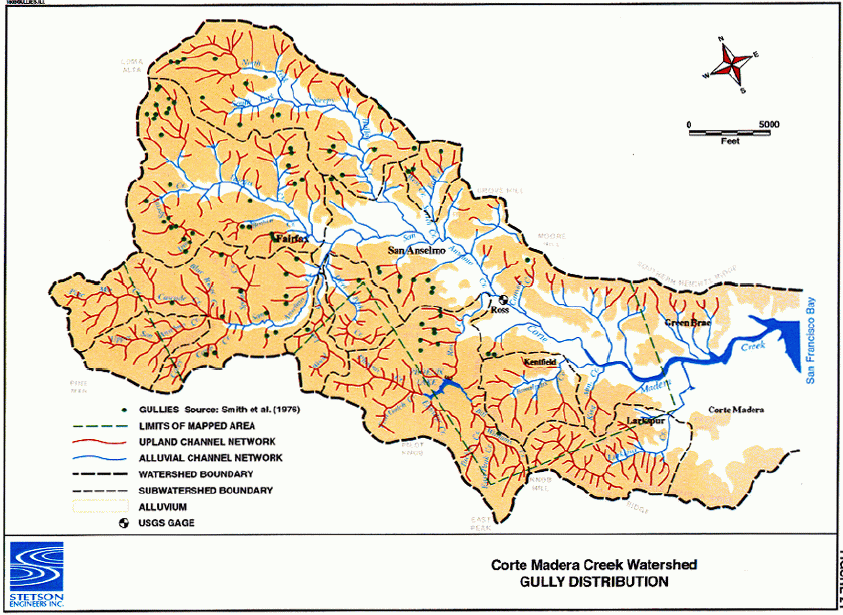 Click on image to enlarge (152K).
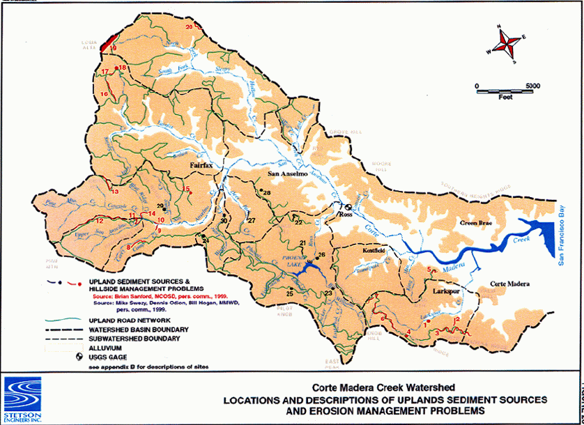 Click on image to enlarge (148K).
To learn more about this topic click Info Links
To view additional information (data source, aquisition date etc.) about this page, click Metadata
| www.krisweb.com |