
| Area | Novato and Miller Creeks |
| Topic | Flow: Annual Peaks Novato Creek at Novato 1947-2001 |
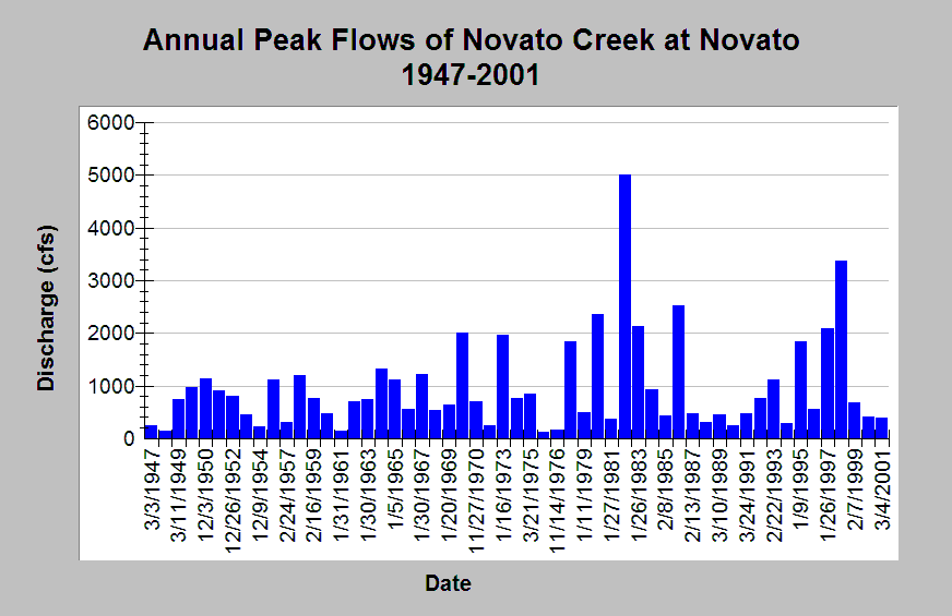
| Caption: This chart displays Novato Creek annual peak discharge measured at Novato, CA between water years 1947 and 2001. The US Geological Survey notes that peak flows have been influenced by diversions since 1952 and urbanization since 1993. Annual peaks were measures at USGS gage #11459500. See Info Links for more Information. | |
 |
To learn more about this topic click Info Links .
To view additional information (data source, aquisition date etc.) about this page, click Metadata .
To view the table with the chart's data, click Chart Table web page.
To download the table with the chart's data, click flow_peak_novato_cr_1946_2001.dbf (size 1,088 bytes)
To download the table with the chart's data as an Excel spreadsheet, click flow_peak_novato_cr_1946_2001.dbf.xls (size 5,120 bytes) .
| www.krisweb.com |