
| Area | Novato and Miller Creeks |
| Topic | Habitat: Tidal Reach Widths in Lower Novato Creek 1854-19411 |
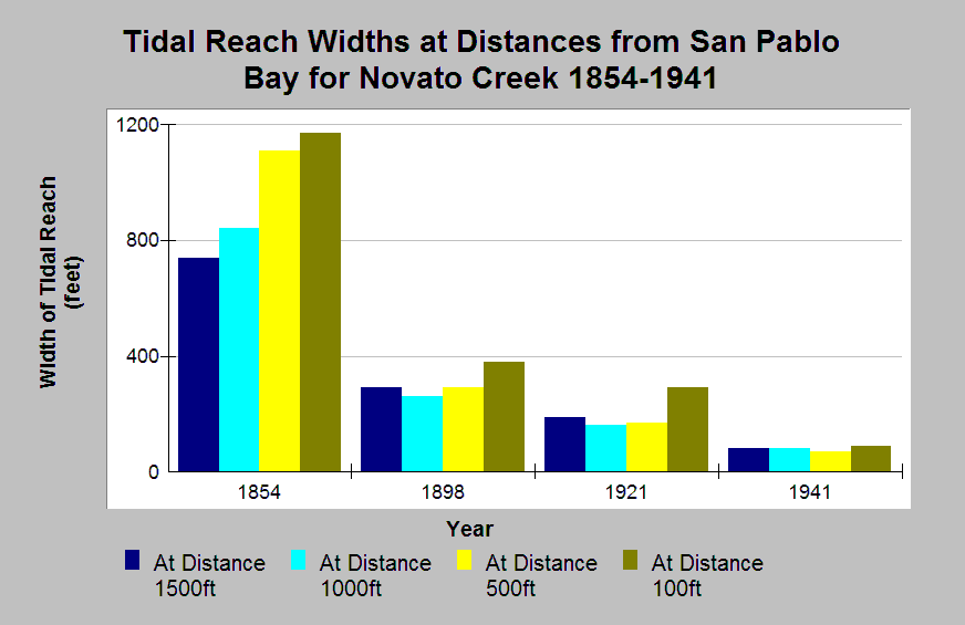
| Caption: The Chart shows tidal reach widths for Lower Novato Creek at different distances from San Pablo Bay. The data show a steady decrease in channel width from 1854 to 1941. During the 19th century, Novato Creek supported commercial navigation (Dedrick, 1993). The extensive tidal marshlands and the network of sloughs at the eastern margin of the alluvial valley were diked and drained for agriculture around the 1860's (Collins, 1998). Data were collected by Laurel Collins. | |
 |
To learn more about this topic click Info Links .
To view additional information (data source, aquisition date etc.) about this page, click Metadata .
To view the table with the chart's data, click Chart Table web page.
To download the table with the chart's data, click tidal_width_collins1998.xls.db (size 4,096 bytes)
To download the table with the chart's data as an Excel spreadsheet, click tidal_width_collins1998.xls.db.xls (size 3,584 bytes) .
| www.krisweb.com |