
| Area | Novato and Miller Creeks |
| Topic | Sediment: Reach Lengths on Lower Novato Creek 1998 |
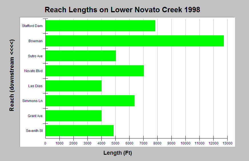
| Caption: The Chart displays reach lengths for a stream survey on Lower Novato Creek in 1998. Notice that surveyed reaches varied significantly in length. Data were collected by Laurel Collins. Click Info Links for more information. See Picture for the location of the study reaches. | |
 |
To learn more about this topic click Info Links .
To view additional information (data source, aquisition date etc.) about this page, click Metadata .
To view the table with the chart's data, click Chart Table web page.
To download the table with the chart's data, click reach_length_collins1998.xls.db (size 4,096 bytes)
To download the table with the chart's data as an Excel spreadsheet, click reach_length_collins1998.xls.db.xls (size 3,584 bytes) .
| www.krisweb.com |