| Area |
Novato and Miller Creeks |
| Topic |
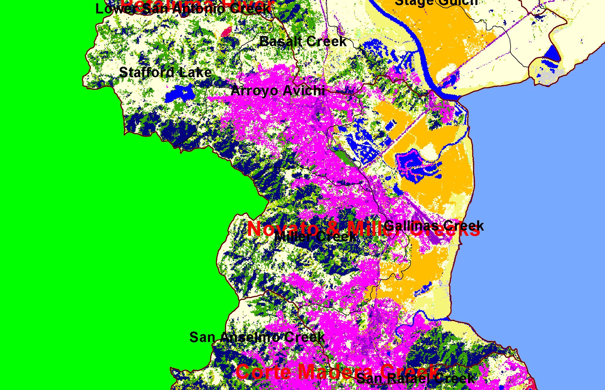
Land Cover: EPA Land-Use, Novato and Miller Creeks Sub-basin 1992 |
|
This is a map of EPA Landcover/Landuse in Calwater Planning Watersheds in the Novato and Miller Creeks sub-basin, based on a 1992 Landsat TM satellite
image. The bayside pale orange areas denoted in the legend as agriculture are cattle pastures. West of the pastures is a band of residential (pink) and
commercial-industrial (purple) areas. The hills above the residential areas are covered in a mix of conifers (dark blue) and hardwoods (green), and grasslands (pale
yellow). Data were provided by the U.S. Environmental Protection Agency.
|
|
|
 |
 |
To view metadata about a map layer, click on a link in the table below.
| Name of Layer in Map Legend | Metadata File Name |
|---|
| Calwater PWS (w/ labels) | calw22.shp.txt |
| Subbasins (w/ labels) | subbasins.shp.txt |
| Frame Project Outline | Unavailable |
| EPA Landcover (1992 Aggregated) | lndcov2.tif.txt |
| Project Area Background | Unavailable |
If you obtain KRIS on a CD and install it on your hard drive as a desktop program, you will have access to increased map capabilities such as zooming in/out, turning layers on/off, adding layers and changing legends.
