| Area |
Novato and Miller Creeks |
| Topic |
Tour: Historic Miller Creek I969, 1973, 1988 |
 Click on image to enlarge (71K). Click here to display a larger version (238K).
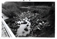
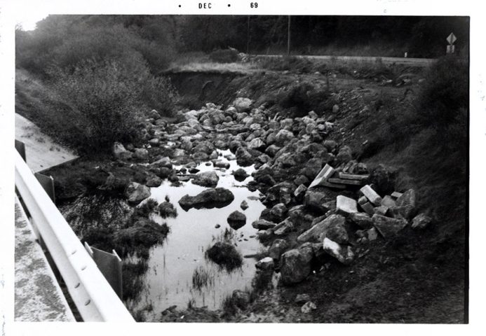
This picture shows Miller Creek downstream from Lucas Valley Road and was taken during December 1969. Photo provided courtesy of the Marin County Stormwater Pollution Prevention Program.
 Click on image to enlarge (74K). Click here to display a larger version (239K).
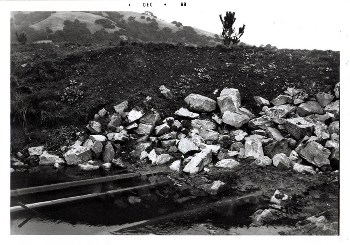
This picture shows Miller Creek downstream from Lucas Valley Road and was taken during December 1969. Photo provided courtesy of the Marin County Stormwater Pollution Prevention Program.
 Click on image to enlarge (78K). Click here to display a larger version (255K).
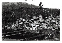
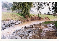
This picture shows Miller Creek, upstream of Lucas Valley Road and was taken during December 1969. Photo provided courtesy of the Marin County Stormwater Pollution Prevention Program.
 Click on image to enlarge (64K). Click here to display a larger version (226K).
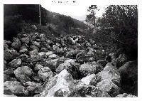
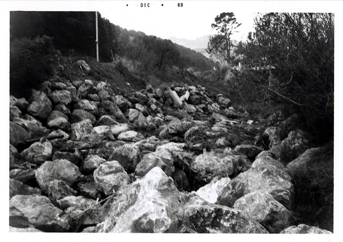
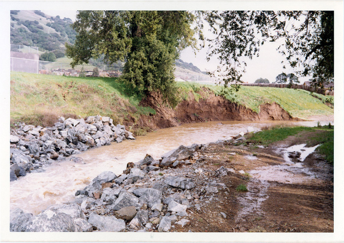
This picture shows erosion on Miller Creek and was taken during January 1969 after heavy rains. Notice the person standing on the opposite bank for spatial reference. Photo provided courtesy of the Marin County Stormwater Pollution Prevention Program.
 Click on image to enlarge (93K). Click here to display a larger version (350K).
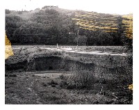
This is a picture of Miller Creek at the Dixie School taken on January 7, 1973. During 1973 this section of the creek was graded and the landuse was changed from agricultural to subdivisions. Since then significant natural revegetation has occurred at this site. Photo provided courtesy of the Marin County Stormwater Pollution Prevention Program.
 Click on image to enlarge (47K). Click here to display a larger version (190K).
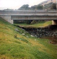
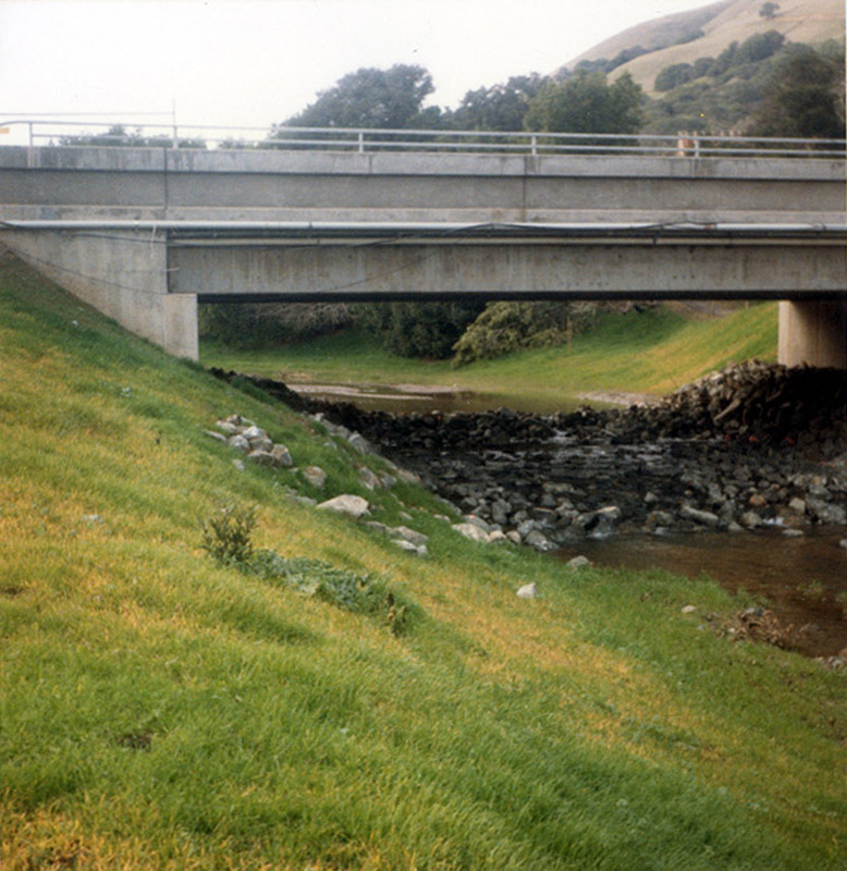
In this photo Miller Creek is shown where it flows through upper Lucas Valley Estates. Philip Williams and Associates conducted a restoration project at this previously incised area in the mid 1980s, which included grading the channel to accommodate a 100 year flood flow. This picture was taken in January 1988 and since the late 1990s this area has become heavily vegetated. Photo provided courtesy of the Marin County Stormwater Pollution Prevention Program.
To learn more about this topic click Info Links
To view additional information (data source, aquisition date etc.) about this page, click Metadata

 Click on image to enlarge (71K). Click here to display a larger version (238K).
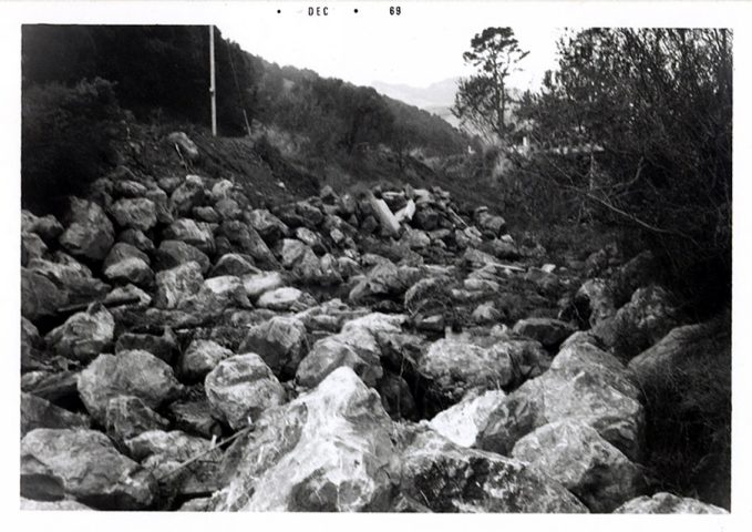 Click on image to enlarge (74K). Click here to display a larger version (239K).
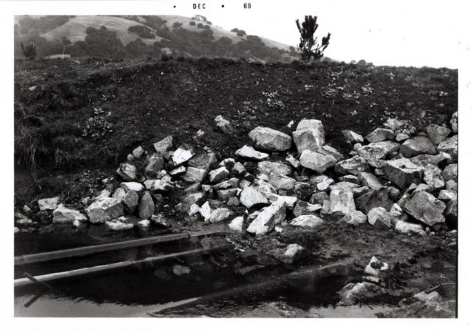 Click on image to enlarge (78K). Click here to display a larger version (255K).
 Click on image to enlarge (64K). Click here to display a larger version (226K).
 Click on image to enlarge (93K). Click here to display a larger version (350K).
 Click on image to enlarge (47K). Click here to display a larger version (190K).
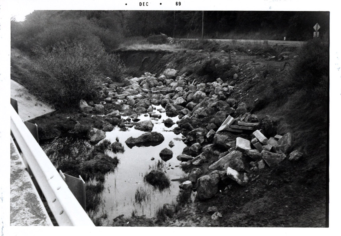