
| Area | Petaluma River |
| Topic | Climate: Annual Rainfall in the Stage Gulch Calwater 1930-1976 |
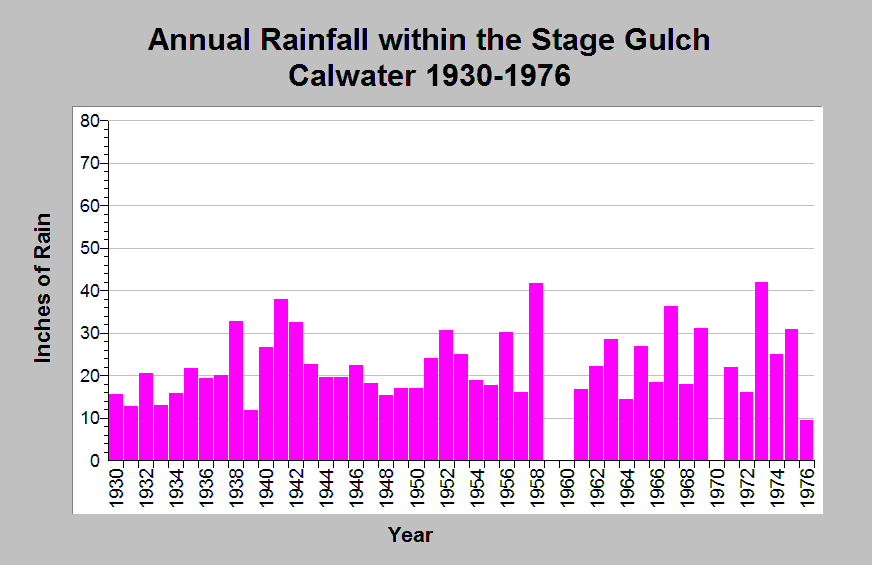
| Caption: This chart shows annual rainfall totals recorded at the Sleepy Hollow Dairy raingage (DWR gage # E20 8286 00) between 1930 and 1976, missing 1959-1960, and 1970. This raingage is located within the Stage Gulch Calwater planning watershed in the Petaluma River sub-basin. Notable dry periods occurred between 1930 to 1937 and 1944 to 1951. The reported rainfall data are point measurements and do not represent the spatial variations existing throughout the entire Calwater planning watershed or the Petaluma River sub-basin. See Info Links for more information. | |
 |
To learn more about this topic click Info Links .
To view additional information (data source, aquisition date etc.) about this page, click Metadata .
To view the table with the chart's data, click Chart Table web page.
To download the table with the chart's data, click climate_rainfall_northbay_cdwr_1874_2002.dbf (size 45,144 bytes)
To download the table with the chart's data as an Excel spreadsheet, click climate_rainfall_northbay_cdwr_1874_2002.dbf.xls (size 26,333 bytes) .
| www.krisweb.com |