
| Area | Sonoma Creek |
| Topic | Climate: Annual Rainfall in Mouth of Sonoma Creek Calwater 1930-1975 |
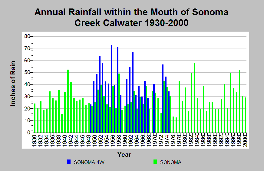
| Caption: This chart shows annual rainfall totals recorded at the Sonoma 4W raingage (DWR gage # E20 8351 08) and Sonoma raingage (DWR # E20 8351 00) between 1930 and 2000. Both raingages are located within the Mouth of Sonoma Creek Calwater planning watershed. Orographic effects cause consistently higher rainfall totals at the Sonoma 4W raingage than at the Sonoma raingage. The reported rainfall data are point measurements and do not represent the spatial variations existing throughout the entire Calwater planning watershed. See Info Links for more information. | |
 |
To learn more about this topic click Info Links .
To view additional information (data source, aquisition date etc.) about this page, click Metadata .
To view the table with the chart's data, click Chart Table web page.
To download the table with the chart's data, click climate_rainfall_northbay_cdwr_1874_2002.dbf (size 45,144 bytes)
To download the table with the chart's data as an Excel spreadsheet, click climate_rainfall_northbay_cdwr_1874_2002.dbf.xls (size 26,333 bytes) .
| www.krisweb.com |