
| Area | Sonoma Creek |
| Topic | Habitat: Pool and Non-Pool Habitat Lengths in Upper Sonoma Creek 1996 |
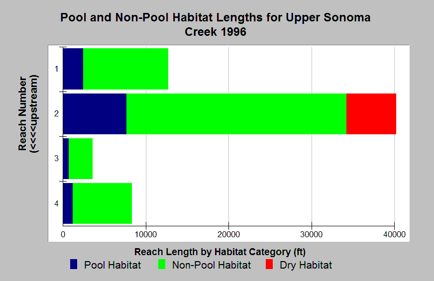
| Caption: The Chart shows pool quantity by reach according to a habitat typing survey conducted in Upper Sonoma Creek in 1996. Blue bands show pool habitat length, green show non-pool habitat, and yellow shows dry habitat. Most of the pool habitat was found in Reach 2, which was also the longest surveyed reach. Reach 2 was comprised of 18% pool habitat. Pools comprised 14-20% of the habitat in each reach. Surveys followed CDFG methods and data provided in Southern Sonoma County RCD report. See Info Links for more information. | |
 |
To learn more about this topic click Info Links .
To view additional information (data source, aquisition date etc.) about this page, click Metadata .
To view the table with the chart's data, click Chart Table web page.
To download the table with the chart's data, click dfg_sonoma_hab_reach.dbf (size 1,582 bytes)
To download the table with the chart's data as an Excel spreadsheet, click dfg_sonoma_hab_reach.dbf.xls (size 5,632 bytes) .
| www.krisweb.com |