
| Area | Sonoma Creek |
| Topic | Land Cover: EPA Land Use, Upper Sonoma Cr Sub-basin 1992 Landsat |
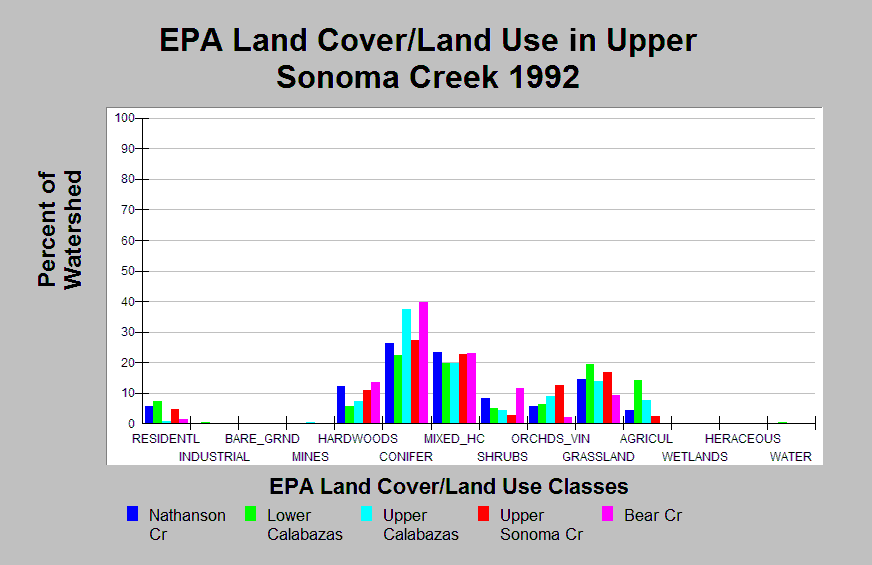
| Caption: This chart displays EPA Land Cover/Land Use data by Calwater Planning Watershed in the upper Calwaters of the Sonoma Creek sub-basin. Classes are derived from a 1992 Landsat image. Calwaters contain conifer and mixed hardwood/conifer forests (19-40%) in higher elevation areas and maintain grassland at lower elevations (9-19%). Agriculture and orchards/vineyards cover 2-14% of these Calwater basins. Nathanson Creek and Lower and Upper Sonoma Creek Calwaters contain 5-8% residential area. Click on the Map tab to view the EPA Land Cover/Land Use GIS layer. Click on Info Links for more information. | |
 |
To learn more about this topic click Info Links .
To view additional information (data source, aquisition date etc.) about this page, click Metadata .
To view the table with the chart's data, click Chart Table web page.
To download the table with the chart's data, click epa_landcover_calwaters.dbf (size 4,370 bytes)
To download the table with the chart's data as an Excel spreadsheet, click epa_landcover_calwaters.dbf.xls (size 10,752 bytes) .
| www.krisweb.com |