
| Area | Sonoma Creek |
| Topic | Climate: Annual Rainfall in Upper Sonoma Creek Calwater 1949-1969 |
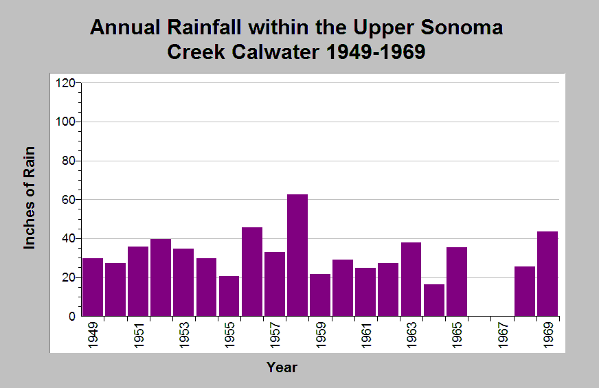
| Caption: This chart shows annual rainfall totals recorded at the Kenwood raingage (DWR gage # F90 4504 01) between 1949 and 1969, missing years 1966 and 1967. This raingage is located within the Upper Sonoma Creek Calwater planning watershed. The reported rainfall data are point measurements and do not represent the spatial variations existing throughout the entire Calwater planning watershed. See Info Links for more information. | |
 |
To learn more about this topic click Info Links .
To view additional information (data source, aquisition date etc.) about this page, click Metadata .
To view the table with the chart's data, click Chart Table web page.
To download the table with the chart's data, click climate_rainfall_northbay_cdwr_1874_2002.dbf (size 45,144 bytes)
To download the table with the chart's data as an Excel spreadsheet, click climate_rainfall_northbay_cdwr_1874_2002.dbf.xls (size 26,333 bytes) .
| www.krisweb.com |