
| Area | Sonoma Creek |
| Topic | Flow: Water Diversions in Sonoma Creek Watershed 1996 |
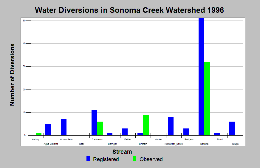
| Caption: This Chart displays the number of water diversions registered with the State Water Resources Control Board Division of Water Rights for Sonoma Creek Watershed as of June 14, 1996 and observed water diversions made during stream surveys in 1996. Stream surveys did not cover all tributaries or all lengths of listed streams. Sonoma Creek was only surveyed in the upper watershed above Madrone Road. Data come from the State Water Resources Control Board Division of Water Rights. Click Info Links for more information. | |
 |
To learn more about this topic click Info Links .
To view additional information (data source, aquisition date etc.) about this page, click Metadata .
To view the table with the chart's data, click Chart Table web page.
To download the table with the chart's data, click diversions_sonoma1996.xls.db (size 4,096 bytes)
To download the table with the chart's data as an Excel spreadsheet, click diversions_sonoma1996.xls.db.xls (size 4,096 bytes) .
| www.krisweb.com |