| Area |
Sonoma Creek |
| Topic |
Tour: Carriger Creek Stream Survey 2000 #1 |
 Click on image to enlarge (75K). Click here to display a larger version (411K).
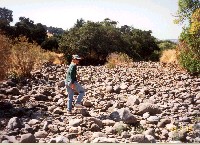
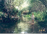
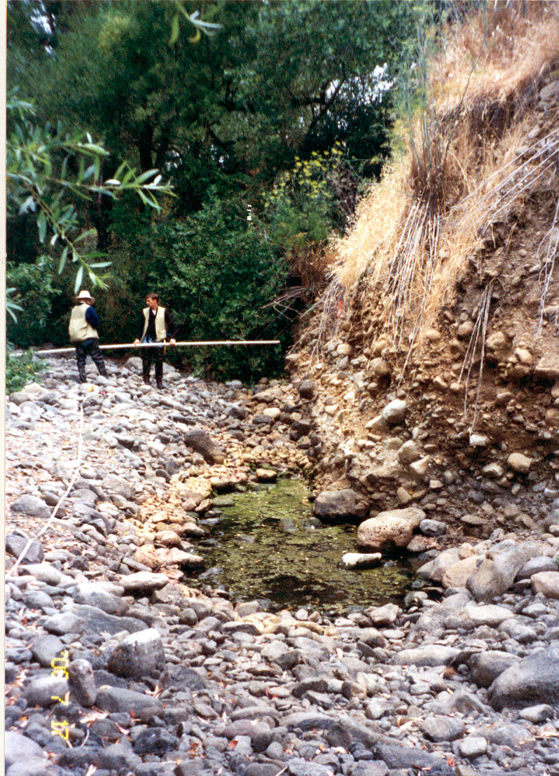
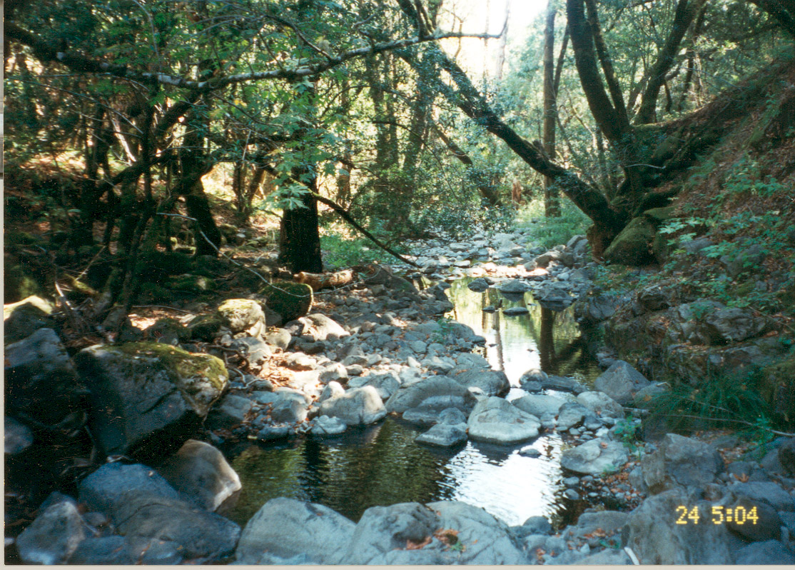
This photo shows a degraded section of Carriger Creek, labeled the Intermittent Reach during stream surveys in 2000. Laurel Collins, pictured here, conducted the survey. Notice the aggraded stream bed, sorted small boulder material, and lack of salmonid habitat features. Photo provided by Laurel Collins.
 Click on image to enlarge (84K). Click here to display a larger version (507K).
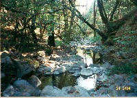
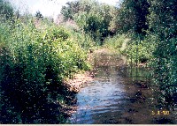
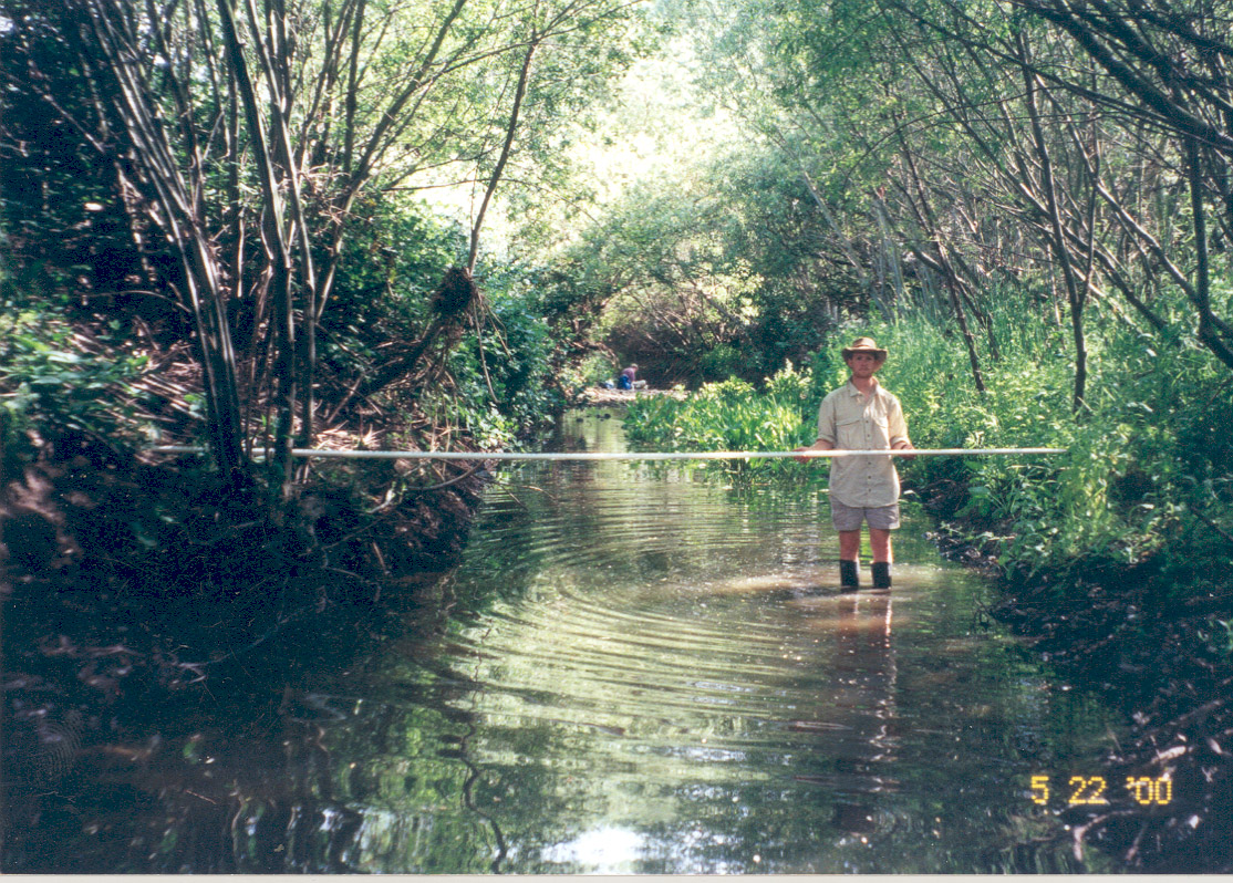
This photo shows a high, unstable bank on an aggraded section of Carriger Creek, labeled the Intermittent Reach during stream surveys in 2000. Notice the algae covered pool and lack of flow. Photo provided by Laurel Collins.
 Click on image to enlarge (71K). Click here to display a larger version (442K).
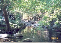
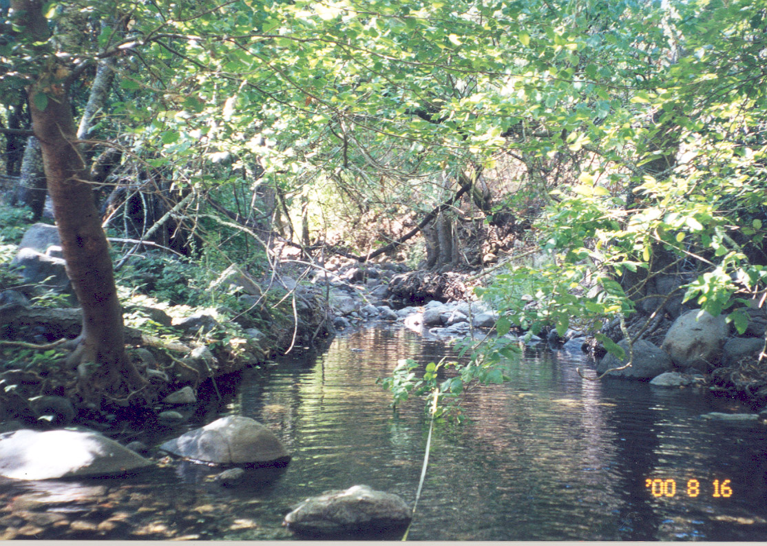
This photo shows a shaded riparian section of Carriger Creek, labeled the Steelhead Reach during stream surveys in 2000. An intact riparian canopy helps keep stream temperatures cool, and boulder scour pools, pictured here, provide valuable juvenile steelhead habitat. Photo provided by Laurel Collins.
 Click on image to enlarge (78K). Click here to display a larger version (458K).
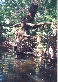
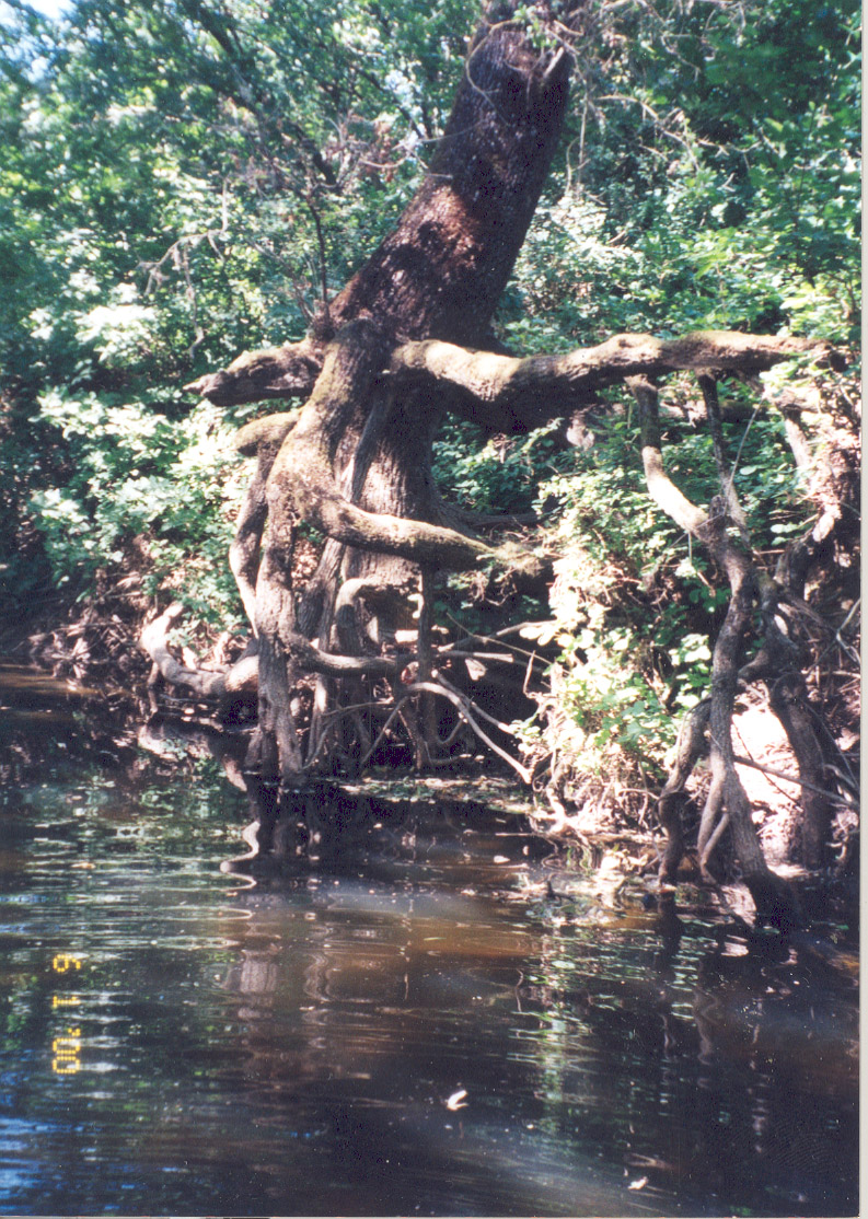
This photo shows a shaded riparian section of Carriger Creek, labeled the Diversion Reach during stream surveys in 2000. The large alder on the left not only provides shade to keep stream temperatures cool, but the root hold together a complex structure of undercut banks and protective cover for juvenile steelhead. Photo provided by Laurel Collins.
 Click on image to enlarge (35K). Click here to display a larger version (317K).
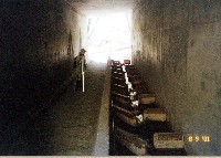
This photo shows a baffled box culvert in a section of Carriger Creek, labeled the Grove Reach during a stream surveys in 2000. The baffles help break up stream velocities for migrating salmonids. Photo provided by Laurel Collins.
 Click on image to enlarge (76K). Click here to display a larger version (490K).
This photo shows a shaded riparian section of Carriger Creek, labeled the Confluence Reach during stream surveys in 2000. Notice the riparian trees growing right down to the banks. Photo provided by Laurel Collins.
 Click on image to enlarge (77K). Click here to display a larger version (514K).
This photo shows a section of Carriger Creek labeled the Distributary Reach during stream surveys in 2000. The cattails are indicative of stagnant, warm water. Photo provided by Laurel Collins.
 Click on image to enlarge (77K). Click here to display a larger version (422K).
This photo shows a section of Carriger Creek, labeled the Riparian Reach during stream surveys in 2000. The old alder root wad in the picture provides important habitat structure for juvenile steelhead. Photo provided by Laurel Collins.
To learn more about this topic click Info Links
To view additional information (data source, aquisition date etc.) about this page, click Metadata

 Click on image to enlarge (75K). Click here to display a larger version (411K).
 Click on image to enlarge (84K). Click here to display a larger version (507K).
 Click on image to enlarge (71K). Click here to display a larger version (442K).
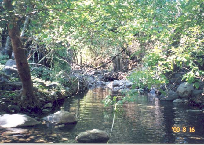 Click on image to enlarge (78K). Click here to display a larger version (458K).
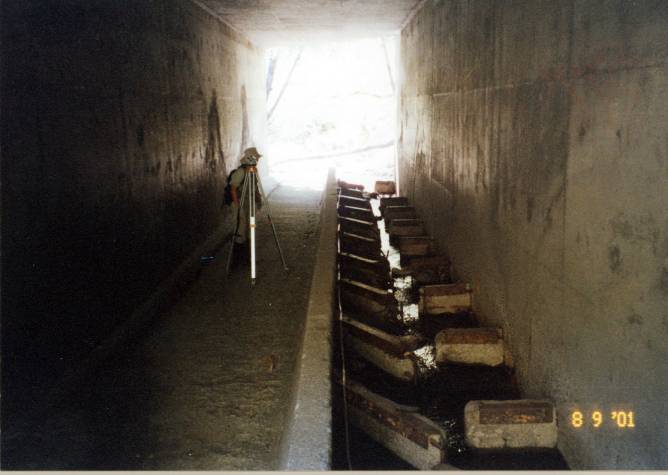 Click on image to enlarge (35K). Click here to display a larger version (317K).
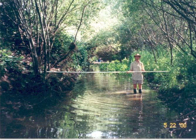 Click on image to enlarge (76K). Click here to display a larger version (490K).
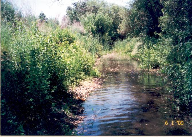 Click on image to enlarge (77K). Click here to display a larger version (514K).
 Click on image to enlarge (77K). Click here to display a larger version (422K).