
| Area | Americano Creek |
| Topic | Land Cover: EPA Land Use in Americano Creek Sub-basin 1992 |
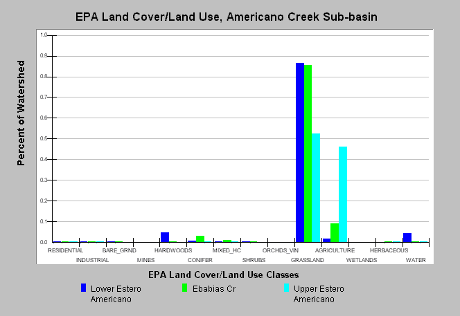
| Caption: This chart displays U.S. Environmental Protection Agency (EPA) Land Cover/Land Use data by Calwater Planning Watershed for the Americano Creek sub-basin. Classes are derived from a 1992 Landsat image. Calwater basins are mainly dominated by grasslands with little forest cover. Upper Estero Americano contains 46% agriculture . Click on the Map tab to view the EPA Land Cover/Land Use GIS layer, showing the locations Land Cover/ Land Use classes presented above. Click on Info Links for more information. | |
 |
To learn more about this topic click Info Links .
To view additional information (data source, aquisition date etc.) about this page, click Metadata .
To view the table with the chart's data, click Chart Table web page.
To download the table with the chart's data, click epa_landcover_calwaters.dbf (size 6,582 bytes) .
To view the table with the chart's source data, click Source Table web page.
To download the table with the chart's source data, click epa_calwater_land_cover.dbf (size 7,986 bytes)
| www.krisweb.com |