| Area |
Americano Creek |
| Topic |
Climate: Americano Creek Annual Rainfall 1951-2000 |
|
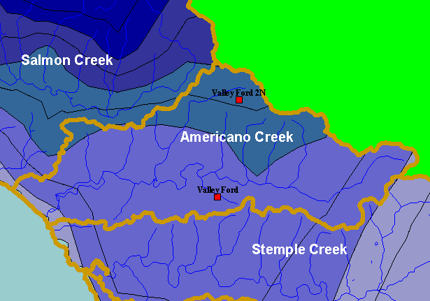
This is a map of rain gauges in the Americano Creek sub-basin. Data are from California Department of Water Resources (DWR).
Displayed in the background are KRIS sub-basins and the annual rainfall model from Oregon State University. Click the check
boxes next to the Elevation and Mean Annual Rainfall layers to see how topography corresponds to rainfall patterns. Other
available layers include a 1:24,000 scale USGS topographic map and Calwater Planning Watersheds. Scale = 1:138,565 .
|
|
|
 |
 |
To view metadata about a map layer, click on a link in the table below.
