
| Area | Regional |
| Topic | Climate: Southern Marin Coast (Muir Woods) Annual Rainfall 1949-2000 |
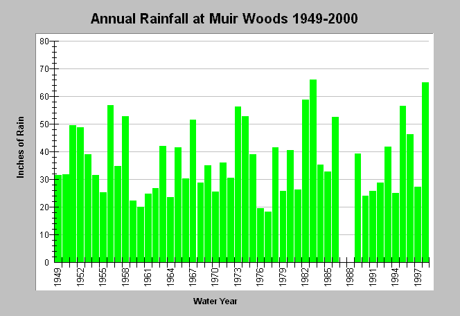
| Caption: This chart shows annual rainfall totals between 1949 and 2000 recorded at the Muir Woods California Department of Water Resources (CDWR) rain gauge (DWR # E20 6027 00). This location is at intermediate elevation and also intermediate rainfall between the coastal Bodega Bay (see previous Topic) and Lagunitas Lake on the shoulders of Mt. Tamalpais. Blank years indicate no data. Click on Map to see CDWR gage locations and rainfall distribution. Click Info Links for more information. | |
 |
To learn more about this topic click Info Links .
To view additional information (data source, aquisition date etc.) about this page, click Metadata .
To view the table with the chart's data, click Chart Table web page.
To download the table with the chart's data, click rain_annual_southmarincoast_south.dbf (size 2,335 bytes) .
| www.krisweb.com |