| Area |
Regional |
| Topic |
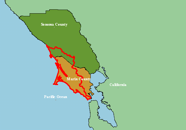
Map: 1A. Project Location of West Marin-Sonoma |
|
This is a map of the regional location of the KRIS West Marin-Sonoma Project Area (red outline), which spans from the Marin and
Sonoma Coast from the Golden Gate to north of Bodega Bay. The elongate feature in the center of the project area is Tomales Bay
and the point extending west is Point Reyes. Scale = 1:1,451,041 .
|
|
|
 |
 |
To view metadata about a map layer, click on a link in the table below.
| Name of Layer in Map Legend | Metadata File Name |
|---|
| label points | labelpts.shp.txt |
| KRIS Project Outline | Unavailable |
| Pacific Ocean | Unavailable |
| Counties | Unavailable |
| California | Unavailable |
