| Area |
Regional |
| Topic |
Climate: Southern Marin Coast (Muir Woods) Annual Rainfall 1949-2000 |
|
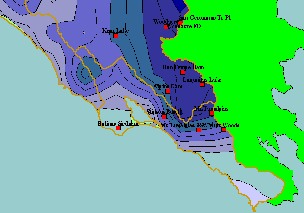
The California Department of Water Resources operates several rain gauges in the KRIS West Martin Sonoma project area,
including the Muir Woods rain gauge for which records are displayed for this Topic. Note that gauges near Mt. Tamalpais have
higher rainfall than places on the coast. Rainfall is higher near mountain peaks due to a phenomenon known as the orographic
effect. Muir Woods is a slight distance from the peak and at lower elevation and, consequently, has lower rainfall. Displayed in the
background are KRIS sub-basins and the annual rainfall model from Oregon State University.
|
|
|
 |
 |
To view metadata about a map layer, click on a link in the table below.
| Name of Layer in Map Legend | Metadata File Name |
|---|
| Rain Gages (DWR) | raingages_wms_dwr.shp.txt |
| Subbasins (no labels) | subbasins.shp.txt |
| Frame Project Outline | Unavailable |
| Mean Annual Rainfall (Inches) | rain61_90.shp.txt |
| Topo Map, North (1:24k scale) | Unavailable |
| Topo Map, South (1:24k scale) | Unavailable |
| Elevation (10 m resolution) | elev10.tif.txt |
| Project Background | Unavailable |
