|
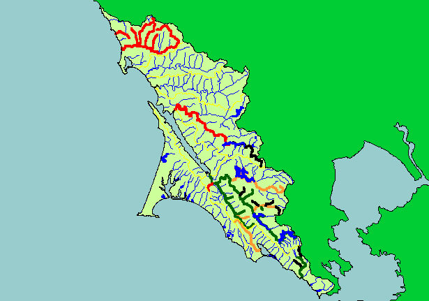
This map shows a summary of the presence/absence of coho salmon young-of-the-year in streams in the KRIS West
Marin-Sonoma project area for the years 1988-1999, displayed with Calwater Planning Watersheds and 1:100,000 scale streams.
Coho persist in Marin County streams in the southern extent of the KRIS West Marin-Sonoma project but they are missing from
Salmon Creek and other streams in the northern project area. This map contains data for all the streams listed as known historically
to harbor coho salmon in a draft California Department of Fish and Game database, but there are likely other historical coho
streams that are not included in that database. Absence data are provisional pending more extensive study, because coho may exist
in some streams but only occur in some years or may have resided in other reaches of streams not surveyed. This map/database
groups data at the scale of entire streams, and differences in coho presence/absence between different reaches in the same stream
are not shown.
|
|