| Area |
Regional |
| Topic |
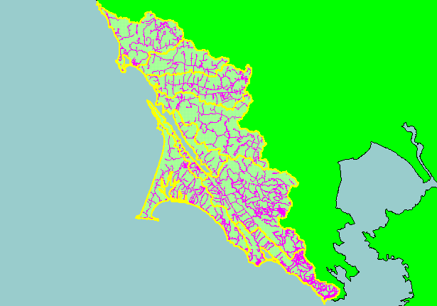
Map: 1F. Roads, West Marin-Sonoma |
|
This is a map of the Roads in the KRIS West Marin-Sonoma project area. The higher areas of road density are in the southern
portion of the project area where urbanization is occurring. Actual roads may be under-represented because it may have been
several years since updating of U.S. Geologic Survey maps. Most of the roads showing in the northern portion of the project are the
county and state roads. Agricultural spur roads or logging roads in northern Salmon Creek are not likely shown. Scale = 1:620,843 .
|
|
|
 |
 |
To view metadata about a map layer, click on a link in the table below.
| Name of Layer in Map Legend | Metadata File Name |
|---|
| Subbasins (no labels) | subbasins.shp.txt |
| Frame Project Outline | Unavailable |
| Roads (1:24k scale) | roads24.shp.txt |
| Roads (1:100k scale) | roads100.shp.txt |
| Topo Map, North (1:24k scale) | Unavailable |
| Topo Map, South (1:24k scale) | Unavailable |
| Project Background | Unavailable |
