| Area |
Regional |
| Topic |
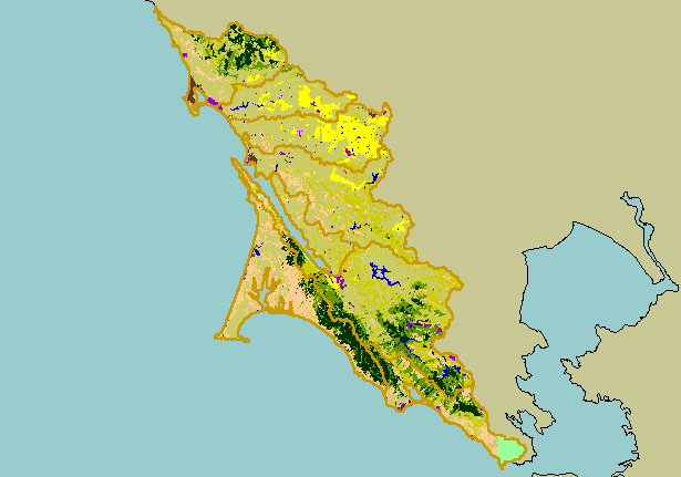
Map: 1I. USFS Vegetation Type, West Marin-Sonoma 1994 |
|
This is a map of 1994 USFS Landsat vegetation type data in the KRIS West Marin-Sonoma project area. Unlike the tree size
coverage in the previous Topic, this map differentiates between hardwoods and conifers.
|
|
|
 |
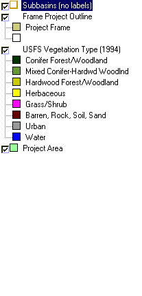 |
To view metadata about a map layer, click on a link in the table below.
| Name of Layer in Map Legend | Metadata File Name |
|---|
| Subbasins (no labels) | subbasins.shp.txt |
| Frame Project Outline | Unavailable |
| USFS Vegetation Type (1994) | vegtype.tif.txt |
| USFS Riparian Veg Size | vegsizebuf.tif.txt |
| USFS Vegetation Size | vegsize.tif.txt |
| Topo Map, North (1:24k scale) | Unavailable |
| Topo Map, South (1:24k scale) | Unavailable |
| Project Area | Unavailable |
