
| Area | Drakes Bay |
| Topic | Land Cover: EPA Land Use in Drakes Bay Sub-basin 1992 |
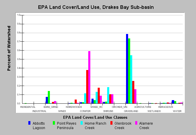
| Caption: This chart displays U.S. Environmental Protection Agency (EPA) Land Cover/Land Use data by Calwater Planning Watershed for the Drakes Bay sub-basin. Classes are derived from a 1992 Landsat image. Calwaters are dominated by grassland and conifer forests. Calwaters extending out to Point Reyes, Abbotts Lagoon and Point Reyes Peninsula are dominated by grasslands, while Glenbrook and Alamere have significant coniferous forests. See Map to view spatial data and Info Links for more information. | |
 |
To learn more about this topic click Info Links .
To view additional information (data source, aquisition date etc.) about this page, click Metadata .
To view the table with the chart's data, click Chart Table web page.
To download the table with the chart's data, click epa_landcover_calwaters.dbf (size 6,582 bytes) .
To view the table with the chart's source data, click Source Table web page.
To download the table with the chart's source data, click epa_calwater_land_cover.dbf (size 7,986 bytes)
| www.krisweb.com |