| Area |
Drakes Bay |
| Topic |
Tour: Muddy Hollow Cr Before/After Restoration Culvert & Road Removal |
 Click on image to enlarge (44K). Click here to display a larger version (218K).
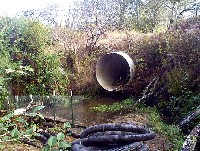
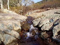
This photo shows Muddy Hollow Creek before removal of the culvert in the center of the photo. The berm across the creek is to trap sediment from the excavation and the black hose is to capture the flow during work and route it around the site. See Picture #2 to see why the culvert had to be removed. Photo provided courtesy of the Point Reyes National Seashore.
 Click on image to enlarge (33K). Click here to display a larger version (163K).
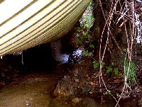
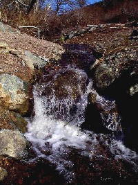
This close up photograph shows that Muddy Hollow Creek has eroded the material underlying this culvert. Since the stream is not large enough to impede foot traffic on the trail on the old road bed, the solution to this potential culvert failure was to remove it (see Picture #5 for after shot). Photo provided courtesy of the Point Reyes National Seashore.
 Click on image to enlarge (106K).
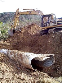
Excavator digs out fill material surrounding the failing culvert shown in Picture #1. Photo provided courtesy of the Point Reyes National Seashore.
 Click on image to enlarge (34K). Click here to display a larger version (181K).
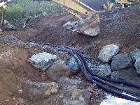
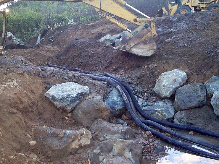
Three black plastic pipes carry the low flow of Muddy Hollow Creek and excavator places large boulders to armor the newly configured channel. Photo provided courtesy of the Point Reyes National Seashore.
 Click on image to enlarge (40K). Click here to display a larger version (199K).
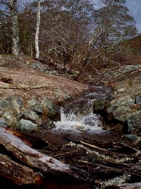
Muddy Hollow Creek during spring flows the year following culvert removal with a stable stream bed and clear water. Photo provided courtesy of the Point Reyes National Seashore.
 Click on image to enlarge (103K).
This photo shows a pool forming at the base of the rock weir placed in the channel of Muddy Hollow Creek after removal of the road bed and culvert. Photo provided courtesy of the Point Reyes National Seashore.
 Click on image to enlarge (109K).
Close up of waterfall at weir where road and culvert were removed. Photo provided courtesy of the Point Reyes National Seashore.
 Click on image to enlarge (111K).
Later storm event stacks large wood below weir at location of road and culvert removal. See the next Picture Tour for more after photos of this restoration site. Photo provided courtesy of the Point Reyes National Seashore.
To learn more about this topic click Info Links
To view additional information (data source, aquisition date etc.) about this page, click Metadata

 Click on image to enlarge (44K). Click here to display a larger version (218K).
 Click on image to enlarge (33K). Click here to display a larger version (163K).
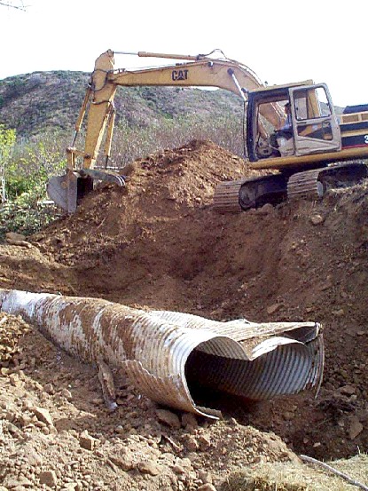 Click on image to enlarge (106K).
 Click on image to enlarge (34K). Click here to display a larger version (181K).
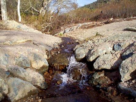 Click on image to enlarge (40K). Click here to display a larger version (199K).
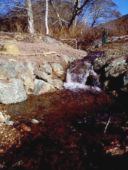 Click on image to enlarge (103K).
 Click on image to enlarge (109K).
 Click on image to enlarge (111K).