| Area |
Drakes Bay |
| Topic |
Tour: Muddy Hollow Cr After Restoration Culvert & Road Removal |
 Click on image to enlarge (30K). Click here to display a larger version (164K).
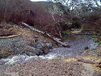
This photo shows the boulder weir at the removed road crossing and culvert seen in the previous Tour during a winter storm. See Picture #2 to see what this site looks like at low flows. Photo provided courtesy of the Point Reyes National Seashore.
 Click on image to enlarge (39K). Click here to display a larger version (196K).
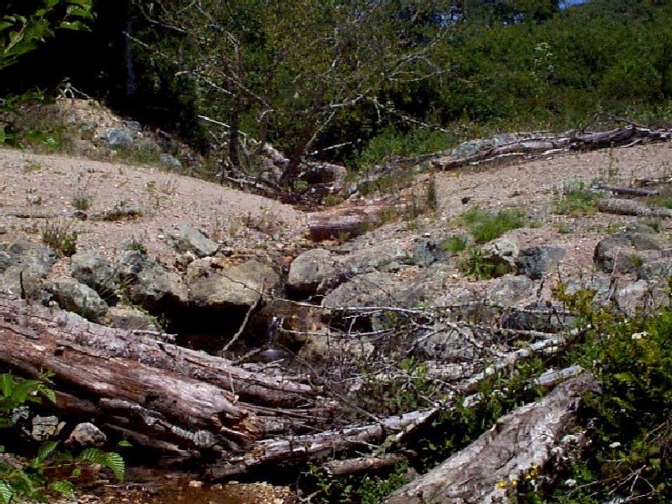
This photo shows the boulder weir at the removed road crossing and culvert at low flows. Note that some vegetation is growing to stabilize bare areas created when the site was excavated. Photo provided courtesy of the Point Reyes National Seashore.
 Click on image to enlarge (39K). Click here to display a larger version (207K).
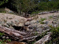
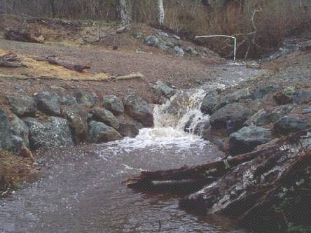
Looking downstream at rock weir during high flows in winter. See Picture #4 to see what this site looks like at low flows. Photo provided courtesy of the Point Reyes National Seashore.
 Click on image to enlarge (42K). Click here to display a larger version (213K).
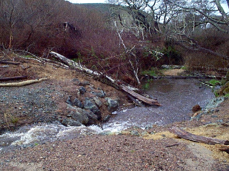
This photo was taken at the same location as Picture #3 but looking up the old road bed and trail and with Muddy Hollow Creek flowing down from the weir at right. Photo provided courtesy of the Point Reyes National Seashore.
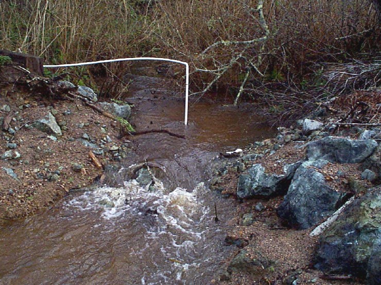
 Click on image to enlarge (37K). Click here to display a larger version (198K).
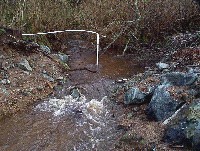
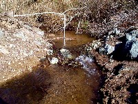
This photo shows the monitoring equipment at a photo point on Muddy Hollow Creek adjacent to the road and culvert removal project. See Picture #6 for a shot of this location at low flows. Photo provided courtesy of the Point Reyes National Seashore.
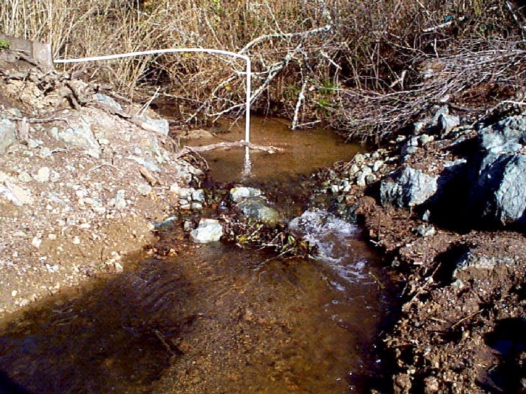
 Click on image to enlarge (45K). Click here to display a larger version (218K).
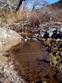
This photo shows low flow conditions at the same Muddy Hollow Creek location as Picture #5. Photo provided courtesy of the Point Reyes National Seashore.
 Click on image to enlarge (134K).
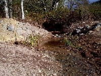
Zoom out at same location as Pictures #5 and #6. Photo provided courtesy of the Point Reyes National Seashore.
 Click on image to enlarge (43K). Click here to display a larger version (215K).
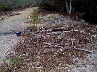
This photo shows wetland plants being introduced at the site disturbed by the removal of a road crossing and culvert. Photo provided courtesy of the Point Reyes National Seashore.
To learn more about this topic click Info Links
To view additional information (data source, aquisition date etc.) about this page, click Metadata

 Click on image to enlarge (30K). Click here to display a larger version (164K).
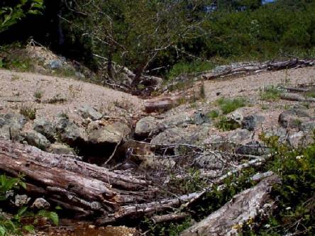 Click on image to enlarge (39K). Click here to display a larger version (196K).
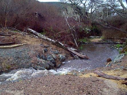 Click on image to enlarge (39K). Click here to display a larger version (207K).
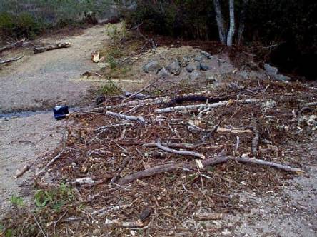 Click on image to enlarge (42K). Click here to display a larger version (213K).
 Click on image to enlarge (37K). Click here to display a larger version (198K).
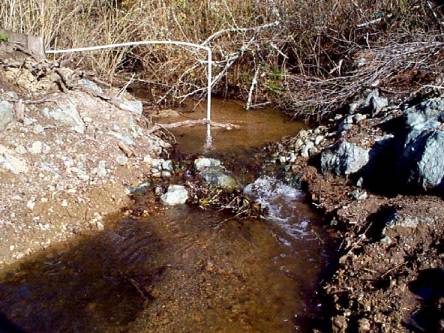 Click on image to enlarge (45K). Click here to display a larger version (218K).
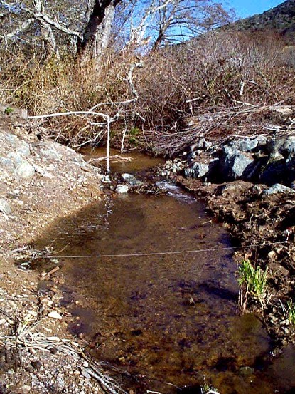 Click on image to enlarge (134K).
 Click on image to enlarge (43K). Click here to display a larger version (215K).
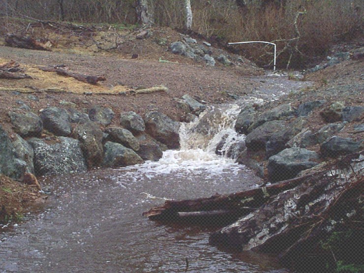