
| Area | Lagunitas Creek |
| Topic | Climate: Kent Reservoir Annual Rainfall 1950-1998 |
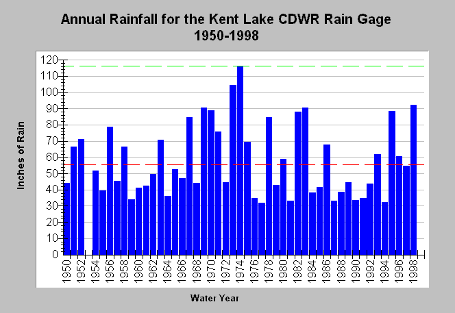
| Caption: This chart shows annual rainfall totals recorded at the California Department of Water Resources (CDWR) gauging station at Kent Lake (DWR # E10 4502 00). Other nearby CDWR gauges include Bear Valley (DWR # E10 0572 00), and the Tocaloma Pump (DWR # E10 8943 20). See the Chart Table for those results. The dashed green line is the maximum rainfall while the red line represents the average rainfall. Blank years indicate no data. See Map for gauge locations and Info Links for more information. | |
 |
To learn more about this topic click Info Links .
To view additional information (data source, aquisition date etc.) about this page, click Metadata .
To view the table with the chart's data, click Chart Table web page.
To download the table with the chart's data, click rain_annual_tomasini_lagunitas_kent.dbf (size 2,012 bytes) .
| www.krisweb.com |