
| Area | Lagunitas Creek |
| Topic | Sediment: Olema Creek Sediment Yield Estimates 1987-1989 |
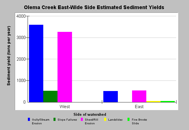
| Caption: This chart shows sediment yield estimates for the upland east and west sides of the Olema Creek watershed. Gully/stream bank erosion and Sheet/Rill erosion are the dominant processes in the watershed with much more erosion coming from the West side of the Olema Creek watershed. Estimates were derived from aerial photos and field inventory by Questa Engineering Corporation for the Point Reyes National Seashore. See Info Links for more Information. | |
 |
To learn more about this topic click Info Links .
To view additional information (data source, aquisition date etc.) about this page, click Metadata .
To view the table with the chart's data, click Chart Table web page.
To download the table with the chart's data, click sediment_olema_ewyield_questa_1986_89.db (size 4,096 bytes) .
| www.krisweb.com |