
| Area | Lagunitas Creek |
| Topic | Climate: Nicasio Annual Rainfall Results 1955-1999 |
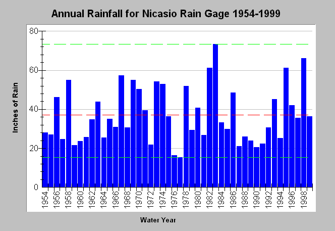
| Caption: This chart shows annual rainfall totals recorded at the California Department of Water Resources (CDWR) gauging station at the town of Nicasio (DWR # E10 6187 01) between 1954 and 1999. Another CDWR gauge is at Nicasio Dam (3NNW) (DWR # E10 6187 02). The red dashed line is the average rainfall while the dashed green lines show the maximum and the minimum. Blank years indicate no data. See Map for gauge locations and Info Links for more information. | |
 |
To learn more about this topic click Info Links .
To view additional information (data source, aquisition date etc.) about this page, click Metadata .
To view the table with the chart's data, click Chart Table web page.
To download the table with the chart's data, click rain_annual_nicasio.dbf (size 1,502 bytes) .
| www.krisweb.com |