
| Area | Lagunitas Creek |
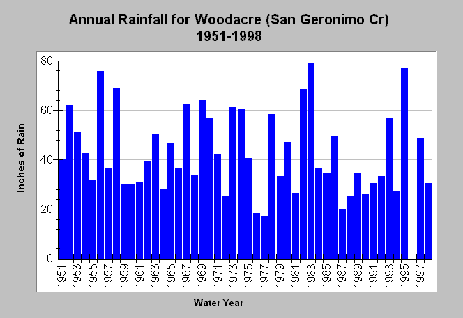
| Topic | Climate: San Geronimo Creek (Woodacre) Annual Rainfall 1951-1998 |
| Caption: This chart shows annual rainfall totals recorded at the California Department of Water Resources (CDWR) rain gauge station at Woodacre FS (DWR # E10 9770 00) within the San Geronimo Creek watershed. The dashed red line is the average rainfall while the dashed green line is the maximum for the period of record. Another gauge with less records is at the town of San Geronimo (DWR # E10 7787 21). Blank years indicate no data. See Map for gauge locations and Info Links for more information. | |
 |
To learn more about this topic click Info Links .
To view additional information (data source, aquisition date etc.) about this page, click Metadata .
To view the table with the chart's data, click Chart Table web page.
To download the table with the chart's data, click rain_annual_sangeronomo.dbf (size 1,558 bytes) .
| www.krisweb.com |