
| Area | Lagunitas Creek |
| Topic | Fish: Spawner Survey, Coho Redds Lagunitas Creek 1997-2001 |
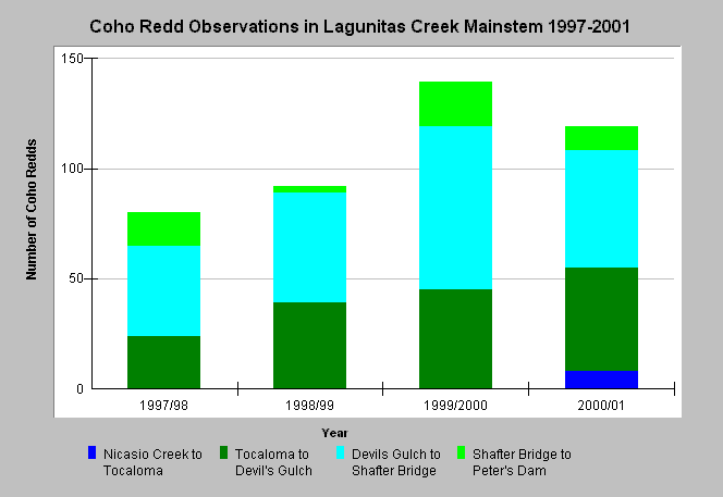
| Caption: The chart shows redds by reach for the mainstem Lagunitas Creek from 1997 to 2001. Spawner survey data provided by the Marin Municipal Water District (MMWD). Spawning activity was most heavily concentrated in the Devils Gulch to Shafter Bridge reach, although the Tocaloma to Devils Gulch reach also had high use. The reach from Nicasio Creek to Tocaloma was only surveyed in 2000-2001. See Map for redd locations and Info Links for more information. | |
 |
To learn more about this topic click Info Links .
To view additional information (data source, aquisition date etc.) about this page, click Metadata .
To view the table with the chart's data, click Chart Table web page.
To download the table with the chart's data, click fish_spawneryearly_mmwd_1997_2001.dbf (size 4,022 bytes) .
To view the table with the chart's source data, click Source Table web page.
To download the table with the chart's source data, click fish_spawnerdaily_mmwd_1997_2001.dbf (size 53,914 bytes)
| www.krisweb.com |