
| Area | Lagunitas Creek |
| Topic | Flow: Lagunitas Creek at Pt Reyes Station 1983-1986 (Comparison) |
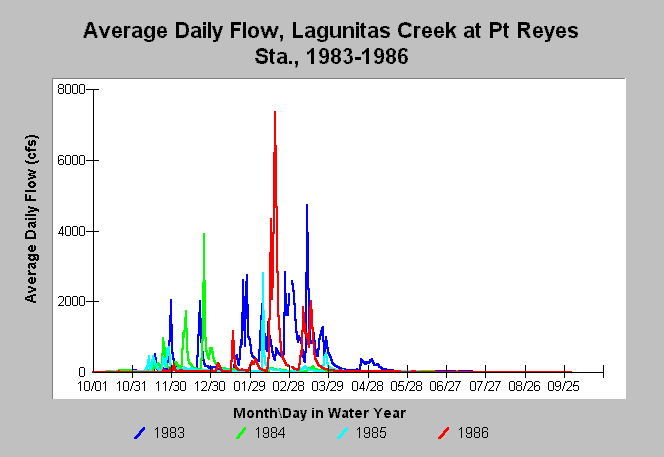
| Caption: This chart shows annual hydrographs using daily average flows in Lagunitas Creek (USGS gauge at Point Reyes Station) for the water years 1983-1986. The peak flow exceeded 7,000 cfs in February 1986 but 1983 was by far the highest cumulative flow year of recent record. Eighty three days over 300 cfs were recorded in that El Nińo year. The water year runs from October 1 to September 30. | |
 |
To learn more about this topic click Info Links .
To view additional information (data source, aquisition date etc.) about this page, click Metadata .
To view the table with the chart's data, click Chart Table web page.
To download the table with the chart's data, click flow_lagunitas_cross.db (size 153,600 bytes) .
To view the table with the chart's source data, click Source Table web page.
To download the table with the chart's source data, click flow_lagunitas.db (size 337,920 bytes)
| www.krisweb.com |