
| Area | Lagunitas Creek |
| Topic | Flow: Lagunitas Creek at Pt Reyes Station, High Flow Days 1975-2001 |
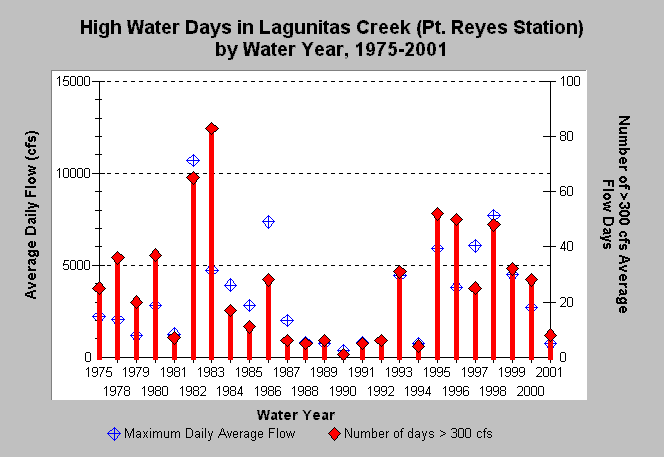
| Caption: The above chart shows the maximum daily average flow recorded (blue symbols) and the number of days where average daily flow exceeded 300 cfs for Lagunitas Creek at USGS gage near Point Reyes Station for water years 1975-2001. The peak flow was in the 1982 water year (10,700 cfs), the following year had the highest number of days over 300 cfs (83 days). The water year begins October 1 of the calendar year prior. | |
 |
To learn more about this topic click Info Links .
To view additional information (data source, aquisition date etc.) about this page, click Metadata .
To view the table with the chart's data, click Chart Table web page.
To download the table with the chart's data, click flow_lag_ptreyes_ex300.db (size 4,096 bytes) .
To view the table with the chart's source data, click Source Table web page.
To download the table with the chart's source data, click flow_lag_doy.db (size 673,792 bytes)
| www.krisweb.com |