
| Area | Lagunitas Creek |
| Topic | Flow: Lagunitas Creek at Pt Reyes Station, Median/Tenth 1975-2001 |
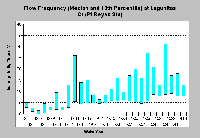
| Caption: This chart shows the median daily average flow (top of bar) and 10th percentile (bottom of bar) at the lower Lagunitas Creek gage (USGS, Point Reyes Station) for the water years 1975-2001. Minimum flow requirements beginning in 1982 are reflected by a higher median in years thereafter. The water year runs from October 1 of the calendar year prior. | |
 |
To learn more about this topic click Info Links .
To view additional information (data source, aquisition date etc.) about this page, click Metadata .
To view the table with the chart's data, click Chart Table web page.
To download the table with the chart's data, click flow_lagprs_boxplot.db (size 6,144 bytes) .
To view the table with the chart's source data, click Source Table web page.
To download the table with the chart's source data, click flow_lag_doy.db (size 673,792 bytes)
| www.krisweb.com |