
| Area | Lagunitas Creek |
| Topic | Flow: Lagunitas Creek at SPT State Park 1987-1990 (Comparison) |
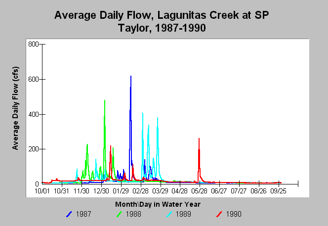
| Caption: This chart shows annual hydrographs using daily average flows in Lagunitas Creek (USGS gauge in Samuel P. Taylor State Park) for the water years 1987-1990. These records show a period of prolonged drought with very few rainstorms in late fall and early winter as required by coho. Flows never reached 300 cfs in the 1990 water year. The water year runs from October 1 to September 30. | |
 |
To learn more about this topic click Info Links .
To view additional information (data source, aquisition date etc.) about this page, click Metadata .
To view the table with the chart's data, click Chart Table web page.
To download the table with the chart's data, click flow_lagunitas_cross.db (size 153,600 bytes) .
To view the table with the chart's source data, click Source Table web page.
To download the table with the chart's source data, click flow_lagunitas.db (size 337,920 bytes)
| www.krisweb.com |