
| Area | Lagunitas Creek |
| Topic | Flow: Lagunitas Creek at SPT State Park 1991-1994 (Comparison) |
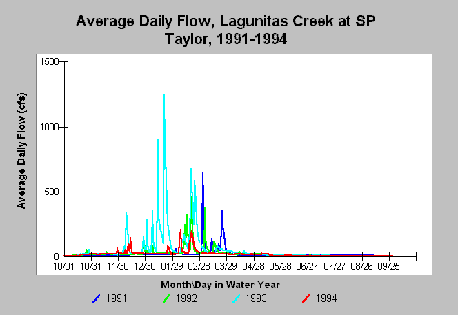
| Caption: This chart shows annual hydrographs using daily average flows in Lagunitas Creek (USGS gauge in Samuel P. Taylor State Park) for the water years 1991-1994. These years constitute the last of a prolonged drought which began in 1987. Only the 1993 water year had rainfall patterns needed by coho for optimal spawning. The water year runs from October 1 to September 30. | |
 |
To learn more about this topic click Info Links .
To view additional information (data source, aquisition date etc.) about this page, click Metadata .
To view the table with the chart's data, click Chart Table web page.
To download the table with the chart's data, click flow_lagunitas_cross.db (size 153,600 bytes) .
To view the table with the chart's source data, click Source Table web page.
To download the table with the chart's source data, click flow_lagunitas.db (size 337,920 bytes)
| www.krisweb.com |