
| Area | Lagunitas Creek |
| Topic | Flow: Lagunitas Creek at SPT State Park, High Flow Days 1983-2000 |
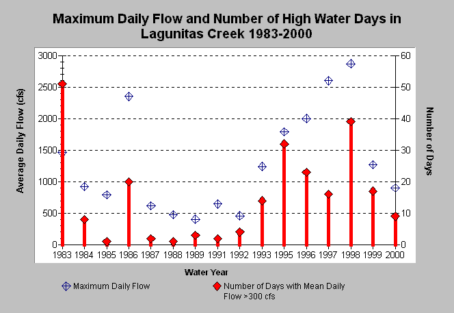
| Caption: The above chart shows the maximum daily average flow recorded (blue symbols) and the number of days where average daily flow exceeded 300 cfs for Lagunitas Creek at the Samuel P. Taylor State Park USGS gage for water years 1983-2000. The years with higher flows would trigger higher substrate mobility. This is an issue below dams because spawning gravels may be washed downstream but not replenished. | |
 |
To learn more about this topic click Info Links .
To view additional information (data source, aquisition date etc.) about this page, click Metadata .
To view the table with the chart's data, click Chart Table web page.
To download the table with the chart's data, click flow_lagspt_ex300.db (size 4,096 bytes) .
To view the table with the chart's source data, click Source Table web page.
To download the table with the chart's source data, click flow_lag_doy.db (size 673,792 bytes)
| www.krisweb.com |