
| Area | Lagunitas Creek |
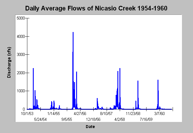
| Topic | Flow: Nicasio Creek at USGS Station 1954-1960 |
| Caption: This chart displays average daily flows (cubic feet per second) by water year for Nicasio Creek at the USGS gauge beginning with water year 1954 and extending to 1960. The water year runs from October 1 to September 30. See Info Links for more information. | |
 |
To learn more about this topic click Info Links .
To view additional information (data source, aquisition date etc.) about this page, click Metadata .
To view the table with the chart's data, click Chart Table web page.
To download the table with the chart's data, click flow_nicasio_usgs_53_60.dbf (size 51,258 bytes) .
| www.krisweb.com |